Category: mid elevation hike
Valhalla Provincial Park
Popular hiking and alpine rock climbing destination.
Hikes:
Mt Gimli
Mt Dag
Alpine Climbs:
Mt Gimli
Mountains:
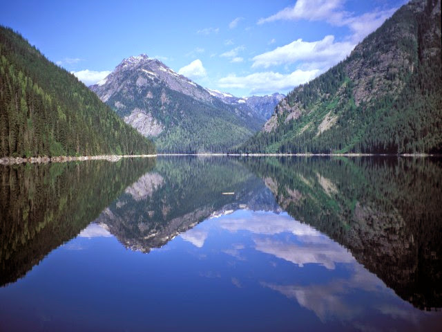
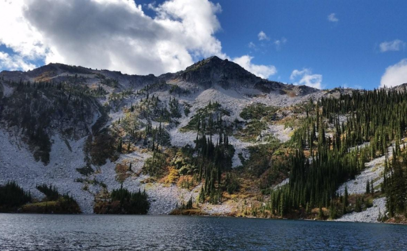
Little Wilson Lake
The drive up the Wilson Creek Forest Service Road is very scenic offering views of a cascading water fall at the 28 km marker and opportunities to do a little fly fishing all along Fitzstubbs Creek, which the road parallels. Little Wilson Lake, surrounded by high peaks, is found at the base of 2350 m Mount Ferrie. This pleasant, open, grassy campsite, well off the forest road offers a quiet get away for the avid fisherman. Little Wilson Lake is ideal for small boats and canoes. Hikers will enjoy exploring old roads and trails along the lake shore. The more ambitious hiker can use this campsite as a base for a trip to the Hamling Lakes area. 3 campsites.
Driving Directions:Turn off Highway 6, at Rosebery, onto the “East Wilson Creek Road”. This road soon turns into the “Wilson Creek Forest Service Road”. Follow this good 2 wheel drive gravel road. At 5 km the road forks, stay left. Just before the orange and white 31 km marker look for a 4×4 post on your left, painted brown with white lettering, signed “Little Wilson Lake”. Turn left here, onto a rough 2 wheel drive dirt road. Follow this road for 800 meters to the campsite.
( source: rec sites and trails )
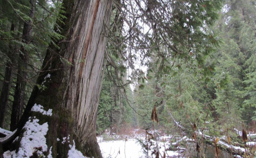
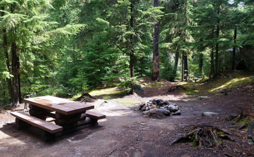
Retallack Cedars Trail
This is a short loop trail through a cedar-spruce ecosystem. An interpretive sign which describes the vegetation and wildlife along the trail is located near the start of the trail. This trail is actively used by bears; large hollow cedar trees have provided den locations in the past. Please stay on developed trails and treat the area with care. Trail may be closed seasonally due to Black Bear activity. Great one for kids. 15-30 minutes.
Driving Directions: Head west from kaslo on highway #31A for 28.6 km (measured from downtown Kaslo) to the old settlement of Retallack. On the west side of the settlement, turn left onto a dirt road and immediately cross over a bridge. The trail starts on the right hand side of the road immediately after the bridge.
( source: rec sites and trails )
Road is also marked with a Big R sign for Retallack catskiing lodge.
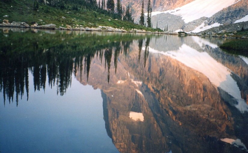
Barrett Lake
Barrett Lake is a beautiful little mountain lake with a small rustic cabin on the shores. There are opportunities for Quading, hiking, fishing, and camping. Barrett Lake is at 1800 Meters. Popular in the winter for snowmobiling and ski touring.
Driving Directions: Access to the Barrett Lake is via Porto Rico Road, 15 km south of Nelson off Highway 6. In summer you can drive up 3 km and park there. (Recommended Quad Access Only from this point). From here you take the lower fork in the road up another 3 km (this section of road is deactivated but is passable in a high clearance 4X4) to a junction, take a right here (about 6 KM up in total). From here, follow the really rough and rocky road for another 4.5 Km up to the lake, stay on the main road on the way up. The last 4.5 Km is extremely rough, and heads to the East up the drainage crossing a South facing rocky slope.
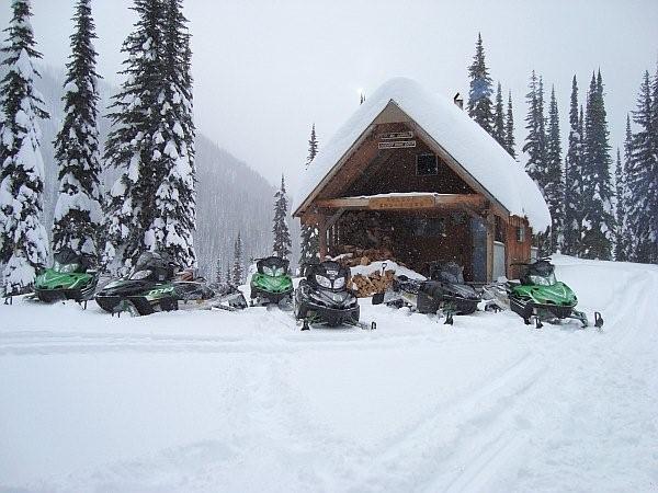
Crusader Cabin Rec Site
This site offers an excellent snowmobiling in the winter. The cabin sleeps 6 comfortably . The Crusader is managed under partnership agreement by the Nelson Sno-Goers and bookings can be made by going to http://nelsonsno-goers.webs.com/ There is a $10 fee per person for overnight use of the cabin. The Fees collected will go directly back into the cabin for maintenance and up-keep.
Driving Directions:Travel north from Nelson on highway #3A for 8.0 km to Six Mile Lakes Road (left hand turn off hwy). Follow Six Miles Lakes main road for 10.0 km to a fork in the road, take the right fork. At 13Km you will find the lakes and the Six Mile Lakes Recreation Site. At 18.5 KM you will reach a major junction in the road, proceed straight; the sharp left will take you down lemon Creek FSR). Stay on the main line until 26.5 Km Reach a junction, where you take the left fork. At 29.5 Km there is a junction, from here there is off road snowmobile trails that lead to the cabin. Cabin GPS Coordinate is 49�46.203 X 117�19.893.
Fletcher Lake Rec Site
This is a steep rustic trail into an alpine lake area. The trail starts on a skid road in a cutblock, and winds its way through dense sub-alpine forest and creekside vegetation to the east end of the lake. The area is heavily used by grizzly bears and site users should take care to make noise when hiking. Hike in groups, and store food out of bear-reach and well away from campsites. The site provides good backcountry camping and fishing. Please pack “ALL” your garbage out with you so bears are not attracted to the area.
Driving Directions:From Balfour, drive 23.0 KM along highway 31 towards Kaslo, and turn left onto a dirt road (4.2 KM north of the Woodbury Creek Resort). Zero your odometer at the start of the Woodbury-Fletcher FSR. At 1.1 KM (the crest of the hill) turn right on to Fletcher Creek Road. At 2.8 KM take the left fork. At 3.7 KM bear right. At 7.3 Km stay left. At 11.5 go right and begin to drive though recent logging. Road is very rough from here (high clearance 4×4) with deep water bars. At 12.5 KM park at the old logging landing. From here walk a few hundred feet along an old de-activated road to find the trail head going off up to the left.
(source: rec sites and trails)
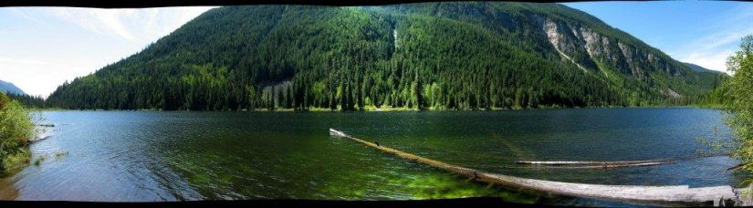
Grizzly Creek Rec Site
Grizzly Creek recreation site is an ideal base camp for explorations up Koch, Greasybill and Grizzly Creeks. This site would make a good rest stop before exploring the rough 4 wheel drive road that goes over the height of land and down to Lower Arrow Lake near Fauquier. The two campsites are scenically situated on rock ledges adjacent to Koch Creek. On a hot summer day the pools below the rock ledges are most inviting. Stream fishing above the bridge rewards the patient angler with brook trout. The surrounding area offers good huckleberry picking and mushroom gathering.
Driving Directions:On Highway 6, near Passmore, look for the Provincial Park signs for “(Valhalla) Drinnon Pass Turn-off”. Following these signs turn left onto “Upper Passmore Road”. The first 3 km of this road are paved. At 3.7 km fork left onto the “Little Slocan Forest Service Road”, a good 2 wheel drive gravel road. Continue on this road following the “Valhalla” signs. At 5.2 km fork right. At 6 km you will cross Airy Creek. At 9 km fork right. At 12.7 km you will cross Koch Creek. At 13.2 km, stop following the “Valhalla” signs and turn left onto the “Koch Creek Forest Service Road”. Travel up Koch Creek for 9.2 km. Turn left, over a major bridge crossing to the other side of Koch Creek. The Grizzly Creek Recreation Site is on your left.
( source : Rec Sites and Trails )
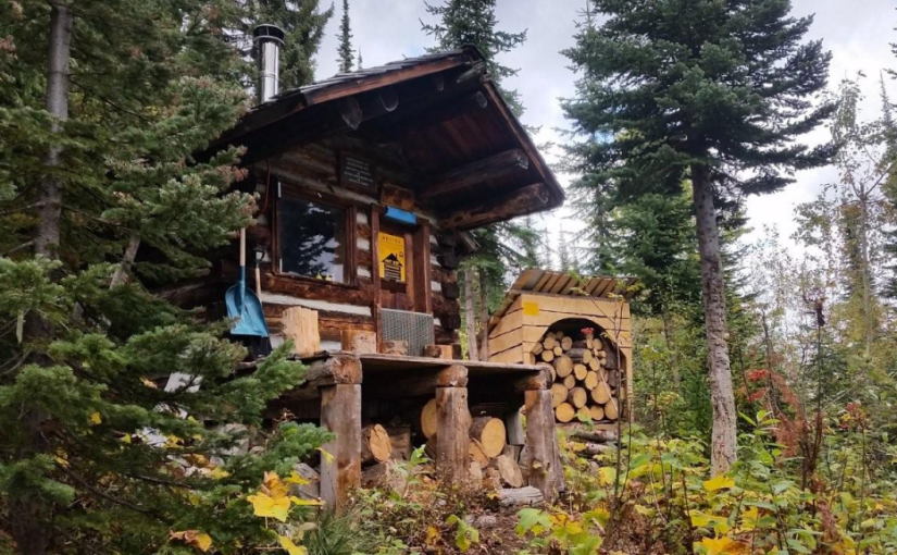
Huckleberry Hut
Huckleberry Hut is a cosy log cabin situated at around 1600 metres in the valley below Midday and Cabin Peaks. It is a small hut with two bunks (no foam mattresses) which will each sleep two. There is also a fold-down table, wood stove and outhouse, and basic cooking utensils (pots, pans, cups, bowls, plates, cutlery, etc.) There is a two burner white gas Coleman Stove and Coleman Lantern, bring spare mantels and white gas. The cabin is maintained under partnership agreement with Kootenay Mountaineering Club. For detailed information and driving directions please visit: http://www.kootenaymountaineering.bc.ca
Driving Directions: Access to the Huckleberry Hut is via Porto Rico Road, 15 km south of Nelson off Highway 6. In summer, with a high clearance four wheel drive vehicle you can drive for six kilometres to a junction where an old road leads off to the left. Park here, and walk the remaining two kilometres to the cabin. In winter a combination of snowmobiles and ski touring gear may be required. The cabin is maintained under partnership agreement with Kootenay Mountaineering Club. For detailed information and drining directions please visit: http://www.kootenaymountaineering.bc.ca/huckleberry.html
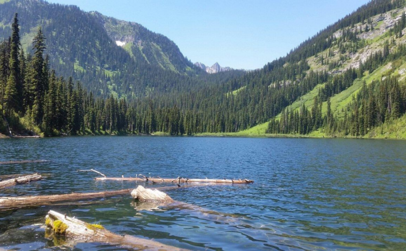
Milford Lake
Milford Lake is a small site at a sub-alpine lake that is accessible by 4wd high clearance vehicles. The site offers scenic views down Kootenay lake and 2 campsites.
Driving Directions:The Milford Lake road leaves the west side of Highway #31, 9.4 km north of Kaslo. Travel up Milford Lake Road for 8.0 km to a junction. Turn right at this junction and continue for another 0.8 km to the lake. Although there are some steep rough sections, the road is suitable for 2wd high clearance vehicles.