Butters is rapidly becoming one of the most popular mountain bike trails in the Slocan Valley. Access is up a steep logging road which if you are not super fit you should definitely consider shuttling this one. The climb is relentless and a little rocky. Take the first left to access lower Butters which is a little steeper and technical than Upper Butters. Lower Butters is mostly blue with some black diamond sections. Upper Butters starts from the second left and is nice and flowy. Small signposts at the trailheads but helpful to have the GPS trail information particularly for accessing the top of lower butters.
Category: Slocan Valley
Passmore, Winlaw, Crescent Valley,
Valhalla Provincial Park
Popular hiking and alpine rock climbing destination.
Hikes:
Mt Gimli
Mt Dag
Alpine Climbs:
Mt Gimli
Mountains:
Mt Gimli
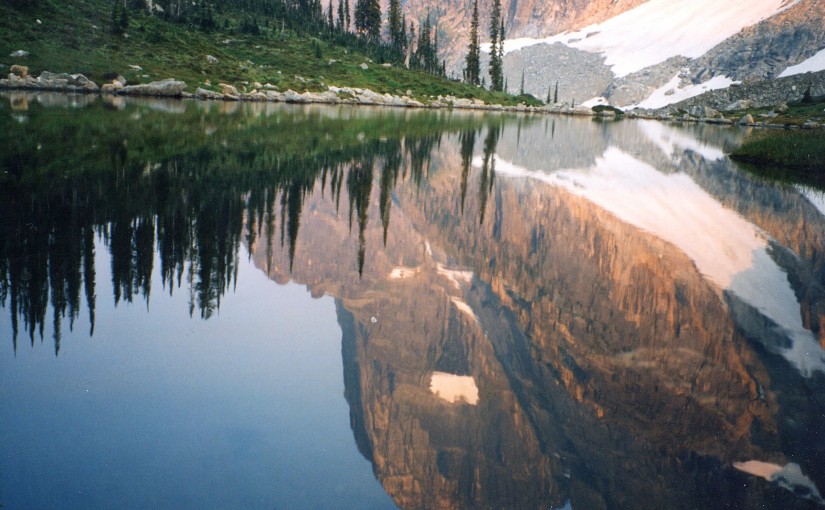
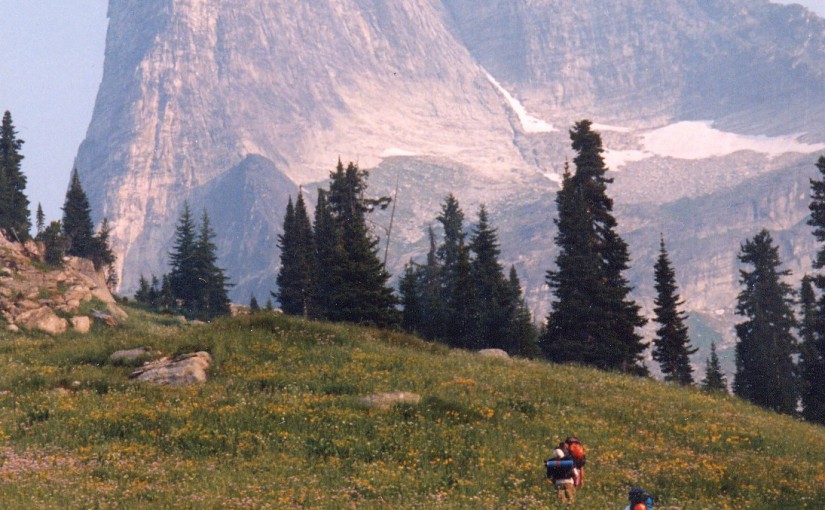
On the edge of the Valhalla Park Mt Gimli is a popular hiking and climbing destination as well as the entry point into the amazing Mulvey Basin.
The 5.10- SE Ridge of Mt Gimli is a 5 star classic multi pitch rock climbing route. The descent is the popular East Ridge which is also a very popular class 4 scramble.
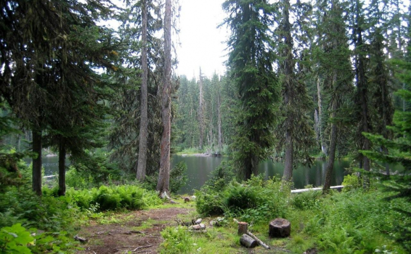
Cooley Lake Rec Site
The drive up to Cooley Lake is a good outing, even if you are not a fisherman. The Goose Creek swimming holes by the bridge (at km 1.5) are worth stopping at on a hot day. Near the 10 km sign on the “Goose Creek Road”, the road traverses an open ridge giving panoramic views of the Bonnington Range, the Valhallas, Shoreacres, Crescent Valley and Krestova. Cooley Lake is a very popular fishing lake that is stocked with rainbow trout. Access to the lake shore is on a short hiking trail through a dense sub-alpine forest. Fishing is done from logs jutting out from the shoreline. There are no tent sites at the lake. Campers stay at the trailhead, just off the road.
Driving Directions:From the junction of Highway 3 and 22, at the overpass in Castlegar, travel east on Highway 3 and Highway 3A towards Nelson for 5.1 km. Turn right at the “Syringa Creek Turn Off” sign onto the “Robson Access Road”. Follow this road for 2.8 km. Turn right onto the “Pass Creek” road. Follow this winding paved road for 11.5 km. Turn left onto the “Goose Creek Road”. The pavement soon gives way to a good 2 wheel drive gravel road that climbs steadily. At 7 km stay right, crossing over Gander Creek. At 9 km stay right, crossing over another small bridge. At 9.3 km stay left, following the main road. At 13.3 km you will get glimpses of Cooley Lake on your right. The parking area for the trail to Cooley Lake is at 13.6 km.
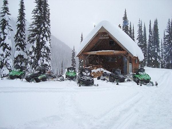
Crusader Cabin Rec Site
This site offers an excellent snowmobiling in the winter. The cabin sleeps 6 comfortably . The Crusader is managed under partnership agreement by the Nelson Sno-Goers and bookings can be made by going to http://nelsonsno-goers.webs.com/ There is a $10 fee per person for overnight use of the cabin. The Fees collected will go directly back into the cabin for maintenance and up-keep.
Driving Directions:Travel north from Nelson on highway #3A for 8.0 km to Six Mile Lakes Road (left hand turn off hwy). Follow Six Miles Lakes main road for 10.0 km to a fork in the road, take the right fork. At 13Km you will find the lakes and the Six Mile Lakes Recreation Site. At 18.5 KM you will reach a major junction in the road, proceed straight; the sharp left will take you down lemon Creek FSR). Stay on the main line until 26.5 Km Reach a junction, where you take the left fork. At 29.5 Km there is a junction, from here there is off road snowmobile trails that lead to the cabin. Cabin GPS Coordinate is 49�46.203 X 117�19.893.
Grizzly Creek Rec Site
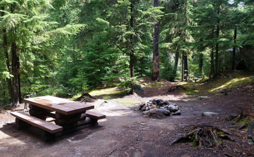
Grizzly Creek recreation site is an ideal base camp for explorations up Koch, Greasybill and Grizzly Creeks. This site would make a good rest stop before exploring the rough 4 wheel drive road that goes over the height of land and down to Lower Arrow Lake near Fauquier. The two campsites are scenically situated on rock ledges adjacent to Koch Creek. On a hot summer day the pools below the rock ledges are most inviting. Stream fishing above the bridge rewards the patient angler with brook trout. The surrounding area offers good huckleberry picking and mushroom gathering.
Driving Directions:On Highway 6, near Passmore, look for the Provincial Park signs for “(Valhalla) Drinnon Pass Turn-off”. Following these signs turn left onto “Upper Passmore Road”. The first 3 km of this road are paved. At 3.7 km fork left onto the “Little Slocan Forest Service Road”, a good 2 wheel drive gravel road. Continue on this road following the “Valhalla” signs. At 5.2 km fork right. At 6 km you will cross Airy Creek. At 9 km fork right. At 12.7 km you will cross Koch Creek. At 13.2 km, stop following the “Valhalla” signs and turn left onto the “Koch Creek Forest Service Road”. Travel up Koch Creek for 9.2 km. Turn left, over a major bridge crossing to the other side of Koch Creek. The Grizzly Creek Recreation Site is on your left.
( source : Rec Sites and Trails )
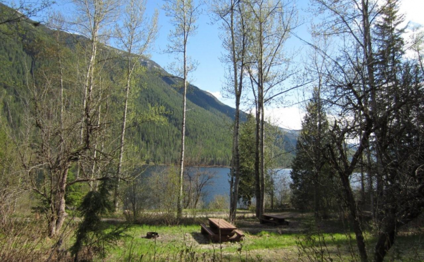
Little Slocan Rec Site
A small, semi-open, lakeside campsite.
Driving Directions:The most popular access to Little Slocan Lakes campsite is from Passmore along Highway 6. As you drive through Passmmore heading north turn left off of the highway onto Passmore Upper Road. Cross the river and follow the road for 3.7 km. Turn left onto the Little Slocan Forest Service Rd.. Stay on the main road for approx 21 km to the recreation site on your right.
Sasquatch Lake Rec Site
Sasquatch Lake Recreation Site offers attractive campsites big enough for group gatherings. The semi-open site is spacious enough for small motor homes and trailers. This site is popular with huckleberry pickers and picnickers. A rock slide along the lake shore gives access to the warm water, making this a popular swimming hole.
Driving Directions:Travelling north on Highway 6 from Appledale, watch for the “Kokanee Glacier Lemon Creek” Provincial Park signs. Just before the bridge over Lemon Creek, follow the signs and turn right onto a good 2 wheel drive gravel road. Follow the “Kokanee Glacier Park” signs on the “Lemon Creek Forest Service Road”. At about 14.5 km turn right onto a dirt road signed “Sasquatch/6 Mile Lakes”. A half kilometre up this road, turn right at the sign to the Sasquatch Lake Recreation Site.
Six Mile Lakes
Six Miles Lake site is a series of three connected sub-alpine lakes. A rustic 3.0 km nature trail on the west side of the lake offers views of the lakes and a pleasant walk through the forest. The trail head is just south of the recreation site on the west side of the road. The end of the trail rejoins the road past the furthest lake, and you can walk back along the road to the trailhead. This is the headwaters of a domestic – use watershed. Please respect the lakes and creeks.
Driving Directions:Travel north from Nelson on highway #3A for 8.0 km to Six Mile Lakes road. Follow Six Miles Lakes road for 10.0 km to a fork in the road. Then take the right fork for 3.0 km to the recreation site . The road is suitable for a 2wd vehicles, although the last 3.0 km are very rough in sections.
(source: Recreation Sites and Trails )
In the winter the six mile lakes circuit is popular with snowmobilers connecting the road across to Lemon creek in the Slocan Valley. Nelson Snowgoers for more information
There are some ski touring destinations in the area as well.