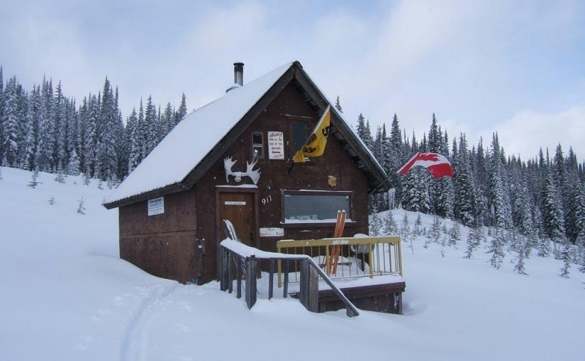
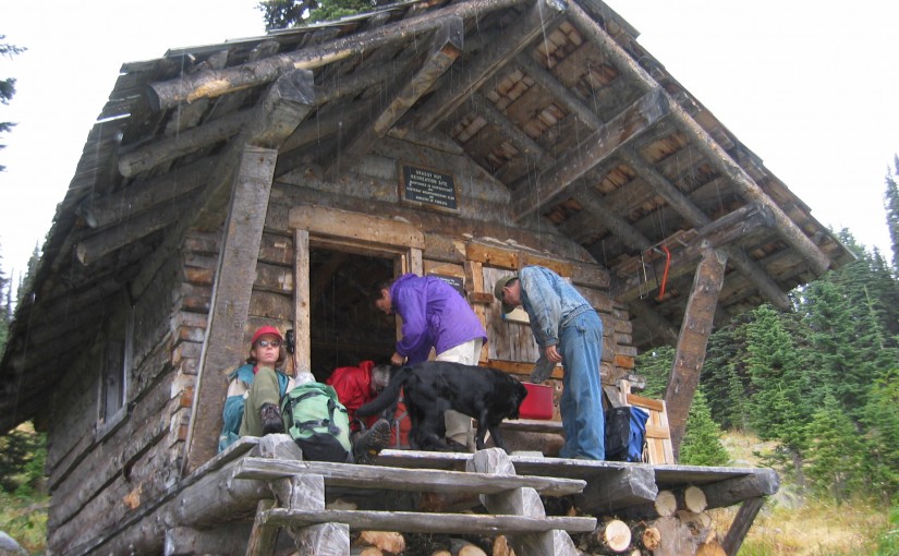
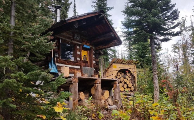
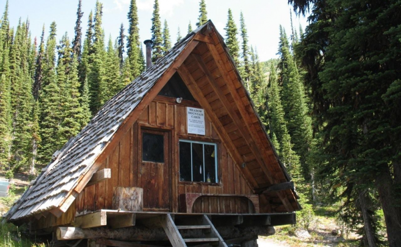
Meadow Mountain Cabin

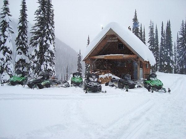
The Meadow Mountain Cabin is managed under partnership agreement by the Nelson Sno-Goers and bookings can be made by going to http://nelsonsno-goers.webs.com/apps/links/ There is a $10 fee per person for overnight use of the cabin. Popular in the spring as a snowmobiling destination. Restrictions apply on snowmobiling in this area as there is a catskiing operation in the vicinity. More Information.

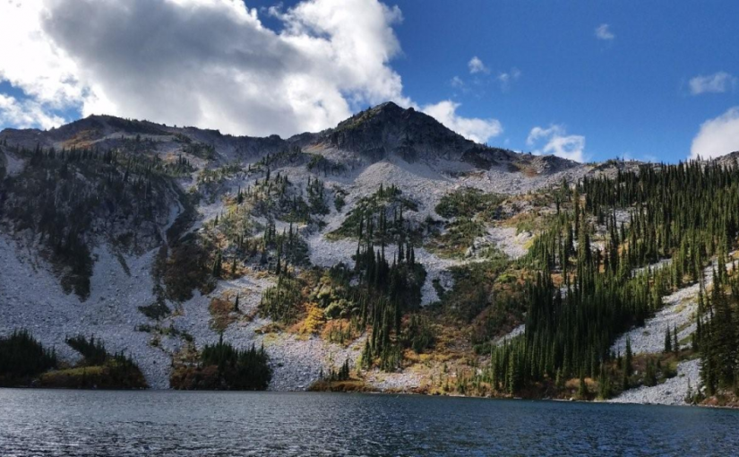
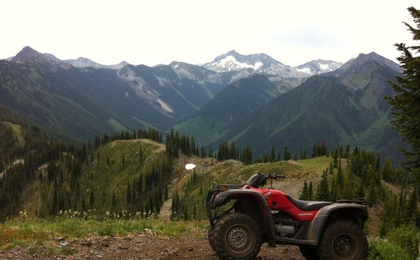
Also great summer hiking opportunities in the area with incredible views of the MtCooperGoat Range. Paragliding from Meadow Mountain and top-landing in spring and summer incredible as well
Driving Directions:From the community of Meadow Creek, take the Meadow Creek road north for 3.1 km until you reach a fork in the road. Take the right fork onto the Meadow Mountain Forest Service Road, cross a bridge and keep to the left at all intersections until you reach kilometre 9.4. At this point take a right, and then a left at 10.3 km. For the remainder of the drive, keep right at all intersections . It’s a long drive. Meadow Mountain is at 28.1 km and the cabin is at 29.0 km. A high clearance vehicle is necessary , and 4wd is recommended as there are steep rough sections on the road.
 

Mary Simpson Cabin ( Retallack-Reco Basin )

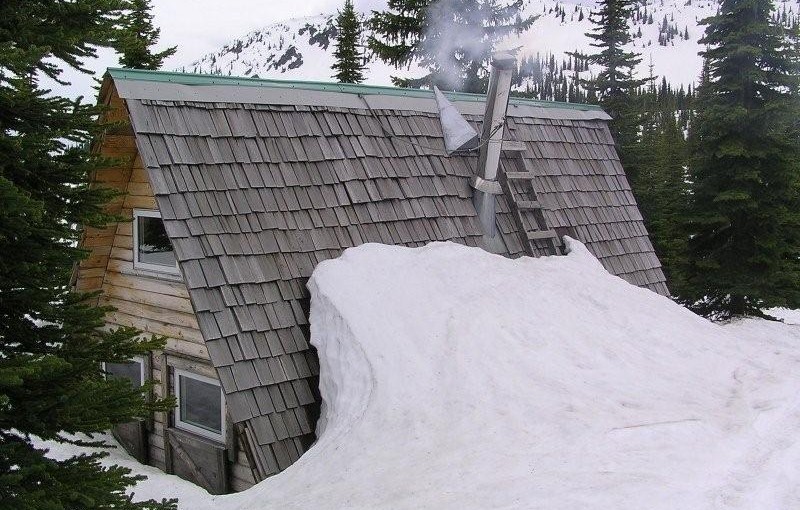
At Retallack follow Stinson Creek FSR ( past the Retallack Catskiing lodge ) up following the left side of the creek until the road crosses the bridge and then take the left fork, continue for another kilometer or so and the cabin is right there. There is some mountain bike activity around the area now so watch for traffic from mountain bikers in the summer and snowcat skiers in the winter. Check in with the Slocan Valley Snowmobile Association and Retallack lodge for activity and closures. Overnight stays must be booked.

The area is popular with ATV’s in the summer doing the Robb Creek Trail, McGuilvary Creek and the trail over the pass into Sandon/Cody.

Retallack Lodge does helicopter and van/truck shuttles on the mountain bike trails in the area.

There are some great summer hiking opportunities from here including the summit of Mt Reco – 2 hours, Texas Peak – 2-3 hours, spectacular ridge systems with incredible views of the Goat Range, Silver Ridge and Kokanee.  More photos

In the winter very busy with snowcat skiing.

Barrett Lake

Barrett Lake is a beautiful little mountain lake with a small rustic cabin on the shores. There are opportunities for Quading, hiking, fishing, and camping. Barrett Lake is at 1800 Meters. Popular in the winter for snowmobiling and ski touring.

Driving Directions: Access to the Barrett Lake is via Porto Rico Road, 15 km south of Nelson off Highway 6. In summer you can drive up 3 km and park there. (Recommended Quad Access Only from this point). From here you take the lower fork in the road up another 3 km (this section of road is deactivated but is passable in a high clearance 4X4) to a junction, take a right here (about 6 KM up in total). From here, follow the really rough and rocky road for another 4.5 Km up to the lake, stay on the main road on the way up. The last 4.5 Km is extremely rough, and heads to the East up the drainage crossing a South facing rocky slope.

Steed Hut

At 2320 metres, Siwash Mountain is the highest peak in the Bonnington Range, and the Steed Cabin, a snug wood cabin built by the KMC in 1995, lies due south of the summit of Siwash Mountain by a small tarn at 2100 metres. A loft in the cabin can sleep four (no foam mattresses), while the downstairs is equipped with table, bench seats and a wood stove. Basic cooking utensils (pots, pans, cups, bowls, plates, cutlery, etc.) are stored in a plastic bin. There is also a two burner white gas Coleman Stove and Coleman Lantern (take spare mantels). You will need to bring your own white gas for the stove and lantern. There is NO water at the Steed Cabin in either summer or winter. The area around the Steed Cabin is popular with snowmobilers, so expect to see snowmobilers when you are staying at the cabin.The cabin is maintained under partnership agreement with Kootenay Mountaineering Club. For detailed information and driving directions please visit: http://www.kootenaymountaineering.bc.ca

Driving Directions: In winter, it takes two days to reach the cabin via the Bonnington Traverse route. In the summer, a four wheel drive vehicle is not necessary. It is possible to drive to the head of Glade Creek, from here, it is between one and three hours of bushwhacking (thick bush with many black and grizzly bears in the area) to reach the cabin. Follow the following driving directions for summer access. Set your odometer to 0 on Highway 3 at Bombi Summit. 0 km = Munson Road and Highway 3, 2.6 km = powerline spur to (R) 3.7 km = Lower Munson to (L), stay (R), 3.9 km = West Munson to (L), stay (R), 5.4 km = East Munson to (R), stay (L), 6.3 km = spur to R, stay on mainline, 6.4 km = spur to (R) is Grassy access, 10.8 km = small pass, road enters from behind and (L), stay straight down the hill, 11.0 km = road forks, go (R) to stay on Munson Road, (L) fork is North Munson, 15.1 km = pass below Twin Peaks, 18.9 km = fork in road, go (L), 22.6 km, = park here and walk the rest of the way.

( source: rec sites and trails )

Copper Mountain hut

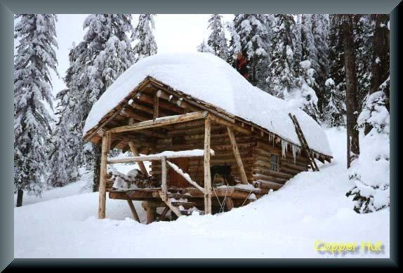
Lying in a thicket of large trees near 2000 metres in a basin on the southwest side of Copper Mountain, the cabin is surrounded by a two hectare area for non-motorized use only. The Copper Mountain cabin is equipped with three bunks (can sleep two each top to tail, no foam mattresses), a wood stove, seating bench and table. Basic cooking utensils (pots, pans, cups, bowls, plates, cutlery, etc.) are stored in small kitchen cabinet. There is also a two burner white gas Coleman Stove and Coleman Lantern (take spare mantels). You will need to bring your own white gas for the stove and lantern. There is NO water at the Copper Mountain Cabin in either summer or winter.The cabin is maintained under partnership agreement with Kootenay Mountaineering Club. For detailed information and driving directions please visit: http://www.kootenaymountaineering.bc.ca

Driving Directions: In summer, the normal access is via an old logging road in 49 Creek. This road leaves the small community of Blewett west of Nelson and is signed �May and Jenny Road� off Blewett Road (exits to your left as you head west). A high clearance four wheel drive is necessary. Follow May and Jenny Road (becomes Copper Mountain Road) for about 12 km to a pass between Red Mountain and Copper Mountain. Either park at the pass (limited) or continue a further 150 metres along the road to a slightly larger parking area. There are no signs. Follow the old road on foot to reach the ridge south of Copper Mountain. An ATV track leads down to the cabin. Allow one to three hours walking time. Winter access is more difficult as the summer route crosses extensive avalanche paths and is unsafe for most of the winter. It is possible to access the Copper Mountain Cabin from roads in the Snowwater Creek drainage. Route finding skill is necessary. Most winter visitors to the cabin are staying at the cabin as part of the Bonnington Range traverse and will have skied across from the Steed Cabin.

Crusader Cabin Rec Site

This site offers an excellent snowmobiling in the winter. The cabin sleeps 6 comfortably . The Crusader is managed under partnership agreement by the Nelson Sno-Goers and bookings can be made by going to http://nelsonsno-goers.webs.com/ There is a $10 fee per person for overnight use of the cabin. The Fees collected will go directly back into the cabin for maintenance and up-keep.

Driving Directions:Travel north from Nelson on highway #3A for 8.0 km to Six Mile Lakes Road (left hand turn off hwy). Follow Six Miles Lakes main road for 10.0 km to a fork in the road, take the right fork. At 13Km you will find the lakes and the Six Mile Lakes Recreation Site. At 18.5 KM you will reach a major junction in the road, proceed straight; the sharp left will take you down lemon Creek FSR). Stay on the main line until 26.5 Km Reach a junction, where you take the left fork. At 29.5 Km there is a junction, from here there is off road snowmobile trails that lead to the cabin. Cabin GPS Coordinate is 49�46.203 X 117�19.893.

Giveout Creek Cabin

The cabin overlooks the Nelson Valley at an elevation of 1730 Meters. The cabin is primarily used for a warming hut for snowmobilers. There are a few bunks in the cabin for overnight use. There is good snowmobiling in the cut blocks surrounding the cabin and in and around the old mining sites.

Driving Directions:The cabin can be accessed off of Hwy 8 to Ymir out off Nelson. Turn east onto Giveout Creek FSR for +/- 1.6 km and then onto Gold Creek FSR for +/- 5 Km, then bear right at the junction. Follow this road for 3 more KM . At this point there is an old logging skid road for 300 meters up to the cabin. There is usually lots of snowmobile tracks leading to the cabin. The trail in is occasionally groomed by the nelson sno-goers club. Cabin Location is N49�25.602 W117�17.722

more information at http://nelsonsno-goers.webs.com/

Grassy Mountain Hut

Grassy Hut lies in the middle of the horseshoe just below the pass between Grassy and south Grassy Mountains. The cabin was built by the KMC in 1985, has four bunks (no foam mattresses), a bench table and seating, and a wood stove. Basic cooking utensils (pots, pans, cups, bowls, plates, cutlery, etc.) are stored in a plastic bin. There is also a two burner white gas Coleman Stove and Coleman Lantern (take spare mantels). You will need to bring your own white gas for the stove and lantern. There is NO water at the Grassy Cabin in either summer or winter. A two hectare area around the cabin is designated for non-motorized use only.The cabin is maintained under partnership agreement with Kootenay Mountaineering Club. For detailed information and driving directions please visit: http://www.kootenaymountaineering.bc.ca/grassy.html

Driving Directions: Access in summer and winter is via logging roads out of Bombi Summit. Follow the following driving directions for summer access. Set your odometer to 0 on Highway 3 at Bombi Summit. 0 km = Munson Road and Highway 3, 2.6 km = power line spur to (R), 3.7 km = Lower Munson to (L), stay (R), 3.9 km = West Munson to (L), stay (R), 5.4 km = East Munson to (R), stay (L) 6.3 km = spur to R, stay on mainline, 6.4 km = spur to (R) is Grassy access. Drive a short distance up this road (about 100 metres) and then park. If you have a two wheel drive vehicle, you will have to park off the main road and walk from there. On foot, follow the old road that leads up to the ridge south of Grassy Mountain. Hike downhill (sketchy trail) to find the cabin. Allow one to three hours hiking time. In winter, follow the same directions but ski directly from the highway. Allow four to six hours.

Huckleberry Hut

Huckleberry Hut is a cosy log cabin situated at around 1600 metres in the valley below Midday and Cabin Peaks. It is a small hut with two bunks (no foam mattresses) which will each sleep two. There is also a fold-down table, wood stove and outhouse, and basic cooking utensils (pots, pans, cups, bowls, plates, cutlery, etc.) There is a two burner white gas Coleman Stove and Coleman Lantern, bring spare mantels and white gas. The cabin is maintained under partnership agreement with Kootenay Mountaineering Club. For detailed information and driving directions please visit: http://www.kootenaymountaineering.bc.ca

Driving Directions: Access to the Huckleberry Hut is via Porto Rico Road, 15 km south of Nelson off Highway 6. In summer, with a high clearance four wheel drive vehicle you can drive for six kilometres to a junction where an old road leads off to the left. Park here, and walk the remaining two kilometres to the cabin. In winter a combination of snowmobiles and ski touring gear may be required. The cabin is maintained under partnership agreement with Kootenay Mountaineering Club. For detailed information and drining directions please visit: http://www.kootenaymountaineering.bc.ca/huckleberry.html

Snowater Cabin

A Snowmobile Warming Hut in the Rover Creek area 10km west of Nelson. For more information on the cabin please contact the Slocan Valley Snowmobile Association. If you are staying overnight in the Cabin please consider making a 10$ / person donation (donation box inside) to help with the maintenance and upkeep of the cabin.

Driving Directions:Contact the Slocan Valley Snowmobile Association if you would like directions to the cabin, otherwise good luck on your adventure!

Nelson Sno-goers map