Horseshoe Lake Rec Site

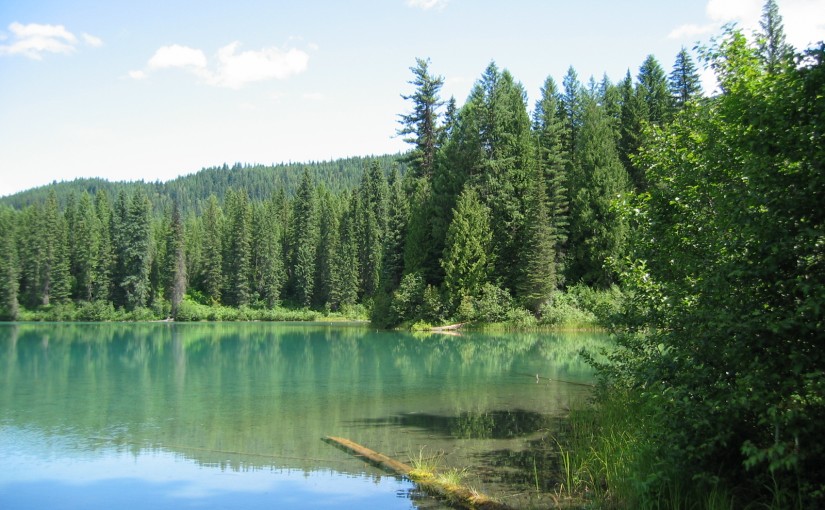
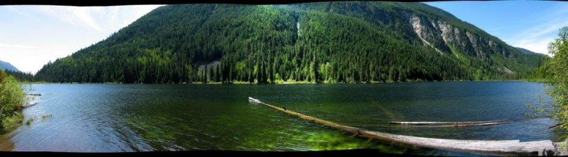
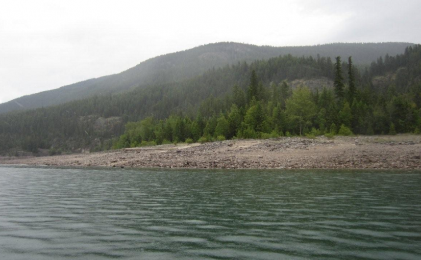
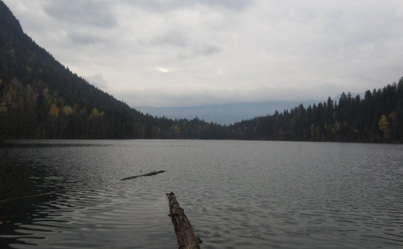
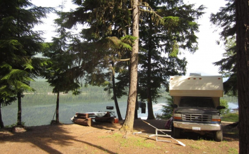
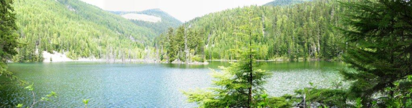
You will often have this quiet little lake all to yourself. Although it is known for good fishing, it is often eclipsed by Wilson Lake. From the road side recreation site near the bridge, one looks across the lake to a small island. A perfect lake to put your canoe into for a paddle and a bit of fishing. This is also a good base camp for exploring the forestry roads beyond by ATV or bike. 2 campsites

Driving Directions: From the junction of Highway 6 and 23 in Nakusp, travel east on Highway 6 towards New Denver for 6.3 km. Turn left onto the “Wilson Lake Road”. Take this good 2 wheel drive, gravel road up Wensley Creek, past the sawmill. Stay left at the “Wilson Lake Forest Service Road” junction. Turn left past the access road to the Wilson Lake West Recreation Site. Continue up the hill. Horseshoe Lake Recreation Site is 400 meters past the 8 km marker.

Larson Lake

This unique aquamarine coloured shallow lake makes a perfect mirror for the surrounding mountains and the forest edge. It is a quiet spot visited by loons and migrating water fowl. The 2 campsite tables are set on the edge of the lake in a small clearing.

Driving Directions:Access from Arrow Park Ferry: At the ferry terminus set your odometer. Your odometer readings will not conform to the km signs on the road. From the ferry terminus travel straight ahead on the “Lower Mosquito Road”. Continue up this road for 6 km. Just after crossing the bridge over Arrow Park (Mosquito) Creek, turn right onto the “Branch 20” road. Follow this road for 3 km. At the junction with the “West Mosquito Road”. Reset your odometer continue straight ahead. Travel north on the “West Mosquito Road” for 11.6 km, to the “27 km” road marker and the junctions of the “West Mosquito Road” with the “Caribou Pass Road” and the “Fostall Road”. Reset your odometer. Continue straight ahead on the “Fostall Road” for another 1.5 km, just after the “20 km” road marker, turn right onto a dirt road. Follow this for 800 meters to the Larson Lake Recreation Site.

Little Wilson Lake

The drive up the Wilson Creek Forest Service Road is very scenic offering views of a cascading water fall at the 28 km marker and opportunities to do a little fly fishing all along Fitzstubbs Creek, which the road parallels. Little Wilson Lake, surrounded by high peaks, is found at the base of 2350 m Mount Ferrie. This pleasant, open, grassy campsite, well off the forest road offers a quiet get away for the avid fisherman. Little Wilson Lake is ideal for small boats and canoes. Hikers will enjoy exploring old roads and trails along the lake shore. The more ambitious hiker can use this campsite as a base for a trip to the Hamling Lakes area. 3 campsites.

Driving Directions:Turn off Highway 6, at Rosebery, onto the “East Wilson Creek Road”. This road soon turns into the “Wilson Creek Forest Service Road”. Follow this good 2 wheel drive gravel road. At 5 km the road forks, stay left. Just before the orange and white 31 km marker look for a 4×4 post on your left, painted brown with white lettering, signed “Little Wilson Lake”. Turn left here, onto a rough 2 wheel drive dirt road. Follow this road for 800 meters to the campsite.

( source: rec sites and trails )

Mary Simpson Cabin ( Retallack-Reco Basin )

At Retallack follow Stinson Creek FSR ( past the Retallack Catskiing lodge ) up following the left side of the creek until the road crosses the bridge and then take the left fork, continue for another kilometer or so and the cabin is right there. There is some mountain bike activity around the area now so watch for traffic from mountain bikers in the summer and snowcat skiers in the winter. Check in with the Slocan Valley Snowmobile Association and Retallack lodge for activity and closures. Overnight stays must be booked.

The area is popular with ATV’s in the summer doing the Robb Creek Trail, McGuilvary Creek and the trail over the pass into Sandon/Cody.

Retallack Lodge does helicopter and van/truck shuttles on the mountain bike trails in the area.

There are some great summer hiking opportunities from here including the summit of Mt Reco – 2 hours, Texas Peak – 2-3 hours, spectacular ridge systems with incredible views of the Goat Range, Silver Ridge and Kokanee.  More photos

In the winter very busy with snowcat skiing.

Mosquito Lake Rec Site

This is a perfect lake for exploring in a small boat or canoe. The irregular edge has several quiet little bays accessible only by water. The lake is popular with families as it offers good fishing and swimming. The Mosquito Lake Recreation Site is well located for a base camp to explore the area and visit some of the other lakes nearby. There are 3 campsites.

Driving Directions:Access from Arrow Park Ferry: At the ferry terminus set your odometer. Your odometer readings will not conform to the km signs on the road. From the ferry terminus travel straight ahead on the “Lower Mosquito Road”. Continue up this road for 6 km. Just after crossing the bridge over Arrow Park (Mosquito) Creek, turn right onto the “Branch 20” road. Follow this road for 3 km. At the junction with the “West Mosquito Road” continue straight ahead. Reset your odometer. Travel north on the “West Mosquito Road” for 11.6 km, to the “27 km” road marker and the junction of the “West Mosquito Road” with the “Caribou Pass Road” and the “Fostall Road”. Reset your odometer. Continue straight ahead on the “Fostall Road” for 8.9 km. Between the “19 km” and “20 km” road markers, at the junction with “Plant Road”, turn left. Travel 800 meters to the recreation site.

( source: rec sites and trails )

Octopus Creek Rec Site

Octopus Creek flows into Lower Arrow Lake. The recreation site is located at the mouth of the creek in a crescent bay. Boaters find it a safe retreat for waiting out storms and sudden winds. During low water, there is an expansive sand and cobble stone beach. Kids can spend endless hours here playing in the water, and moving sand and rocks around. The water warms up later in the summer and is quite pleasant for swimming and board sailing. Arrow Lake is known for Kokanee fishing. However, if the fish are not biting, there is still lots to do at Octopus Creek. Hikers can hike up the creek searching for the natural hot springs. At low water there is miles of beach to walk.

Driving Directions:Due to private land issues this site has been changed to BOAT ACCESS ONLY

Retallack Cedars Trail

This is a short loop trail through a cedar-spruce ecosystem. An interpretive sign which describes the vegetation and wildlife along the trail is located near the start of the trail. This trail is actively used by bears; large hollow cedar trees have provided den locations in the past. Please stay on developed trails and treat the area with care. Trail may be closed seasonally due to Black Bear activity. Great one for kids. 15-30 minutes.

Driving Directions: Head west from kaslo on highway #31A for 28.6 km (measured from downtown Kaslo) to the old settlement of Retallack. On the west side of the settlement, turn left onto a dirt road and immediately cross over a bridge.  The trail starts on the right hand side of the road immediately after the bridge.

( source: rec sites and trails )

Road is also marked with a Big R sign for Retallack catskiing lodge.

Saddle Mountain Fire Lookout

Saddle Mountain Fire Lookout sits on top of Saddle Mountain elevation 2304 m / 7559 ft , to the North is Upper Saddle Mountain elevation 2330 m / 7644 ft . The view is spectacular of Arrow Lake and Nakusp BC . To the west is Pinnacle Peak elevation 2573 m / 8441 ft . and the Monashee Mountians. 3-5 hour hike. 2 hour drive access from Nakusp. More information from www.nakusptrails.ca

Driving Directions: Off Hwy 6 onto Arrow Park Road which will also cross the lake with Arrow Park Ferry for +/- 1.4 km and heading in a Northwesterly direction linking up to Saddle Bay South One Forest Service Road for +/- 3.7 km. . Then onto a logging road for +/- 3.7 km continuing along the lake Northward. Then you will arrive at Saddle Mtn. Forest Service Road and travel west up a winding road for +/- 8.2 km to the lookout trail head from this point it is a steep hike .

Snowshoe Lake Rec Site

This small fishing lake, tucked into the hills, is a pleasant spot to while away a few hours or days. Although there is not a boat launch, the road goes close enough to the lake that a canoe can easily be put in. There is a choice of grassy or treed campsites.

Driving Directions:Access: From the Needles Rest Area at the ferry terminus, travel west on Highway 6 for 14.4 km.Just before the highway crosses Inonoaklin Creek, turn right onto a 2 wheel drive gravel road. Follow this road through the gravel pit onto a rough dirt road. After crossing a cattle guard at 1.5 km the road forks. Take the right fork, marked with a brown 4×4 post with white lettering, signed “Snowshoe Lake”. Continue along this road for another 3 km to the recreation site. Note: this road is suitable for high clearance 2 wheel drive vehicles in dry weather. Alternate Access: From the Needles Rest Area at the ferry terminus, travel west on Highway 6 for 4.4 km. Turn right onto the “Whatshan Lake Road”. At the junction with the Barnes Creek road, turn left and cross over the Whatshan River. Just past the power station, which is at the “7 km” marker on the “Barnes Creek Forest Service Road”, turn left onto the “Snowshoe Lake Road”, which is marked with a white and red sign, nailed to a tree. Proceed 1.4 km. Turn left onto a road marked “Branch 1”. Proceed 1.5 km to just past a “10 km” yellow and black marker on the right hand side of the road. Turn right onto a narrow, dirt 2 wheel drive road that follows the power lines for 2 km to Snowshoe Lake. Note: the last 1.6 km is very steep, narrow and rutted, suitable for high clearance 2 wheel drive vehicles in dry weather.

(source: rec sites and trails)

Stevens Creek Rec Site ( Whatshan lake )

Whatshan Lake is a boating and popular fishing lake with more to offer than just big fish. In summer the lake warms up to very pleasant swimming temperature. Stevens Creek is very scenic. Whatshan Peak is directly across the lake and the Pinnacles loom in the distance. Large white pine trees shade level campsites. Some of the sites are clustered together, making them perfect for group camping. There is a day use area for picnicking and enjoying the pea gravel and sand beach. Camping Fees will be collected from May to October Annually at a rate of $12.00/night. Boat Launch

Driving Directions: Access from the Needles Ferry: Zero your odometer at the Needles ferry landing on the Edgewood side. At 3.2 KM turn right off the highway on to Whatshan Lake Road. At 4.7 KM turn right on to Whatshan Forest Service Road. At 5.6 KM find a junction, stay on the main line. At 18.5 Proceed Left and stay on the Whatshan FSR. At 26.8 KM proceed left at the junction staying on the Whatshan FSR. At 27 KM pass the Richy Recreation Site on the left. At 28.8 Find Stevens Creek Recreation Site on the left. Directions from Arrow Park Ferry: When leaving the ferry stay left onto: Stevens Road to Needles. At 8.9 Km take the left fork sign: To Needles/ Old Arrow Park . At 11.5 Km take the right fork sign: Whatshan Lake Richy/ Stevens. AT 23.2 Km Stay right onto Branch 1 Stevens. At 24.7 Km hairpin left onto Whatshan Rd. going South. At 26.1 Km Stevens Campground on Right. At 28.3 Km Richy Campground on Right.