Kokanee Creek Old Growth Trail

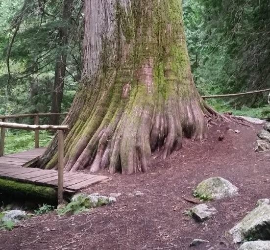
This is an easy to moderate interpretive trail through an old cedar/hemlock forest. Features of the trail include large stands of huge cedar tree, lush creek side habitat, an avalanche path, and historic remains of turn-of-the-century mining and logging.

Driving Directions:Travel east of Nelson for 19.0 km on highway #3A to the Gibson Lake/Kokanee Glacier Provincial Park access road. Travel along the access road for 11.4 km to the trailhead sign. Parking for 6 vehicles is located approximately 50 meters beyond the trailhead sign. When starting the trail, keep to the left at the fork. The right fork leads down to a viewpoint.

Little Slocan Rec Site

A small, semi-open, lakeside campsite.

Driving Directions:The most popular access to Little Slocan Lakes campsite is from Passmore along Highway 6. As you drive through Passmmore heading north turn left off of the highway onto Passmore Upper Road. Cross the river and follow the road for 3.7 km. Turn left onto the Little Slocan Forest Service Rd.. Stay on the main road for approx 21 km to the recreation site on your right.

Milford Lake

Milford Lake is a small site at a sub-alpine lake that is accessible by 4wd high clearance vehicles. The site offers scenic views down Kootenay lake and 2 campsites.

Driving Directions:The Milford Lake road leaves the west side of Highway #31, 9.4 km north of Kaslo. Travel up Milford Lake Road for 8.0 km to a junction. Turn right at this junction and continue for another 0.8 km to the lake. Although there are some steep rough sections, the road is suitable for 2wd high clearance vehicles.

Oliver (Johny Connors) Lake

This is a small site located in a scenic alpine basin with a shallow lake. There is a short trail on the east side of the road to the shallow lake and around it. Access can also be gained to the surrounding ridges, although there are no developed trails.

Driving Directions:From the community of Crawford Bay, head south for 200 meters on Highway3A, and then turn left on Oliver road just past the Gray Creek store. Follow this road for 300 meters and then turn right, crossing Grey Creek. Follow this road , now called Anderson road, for 1.3 km, turning left at the junction. Follow the main Grey Creek road 15.0 km to the campsite.

Pebble Beach Rec Site

This is a popular sunbathing, swimming, and camping site. It is located in a small protected bay on the east shore of Kootenay Lake with a pebble beach surrounded by exposed rock. The site offers fishing, hiking, camping, picnicking, and swimming.

Driving Directions:From the community of Riondel on the East shore of Kootenay Lake, take a right turn onto Eastman Avenue and proceed to Tam O’Shanter Cr. Take the Kootenay Lake East Forest Service Road for 3.2km to the trail head. Park your vehicle on the left side of the road by the trail head sign. A moderate 2.0km trail located on the west side of the road leads into the site. This site is also accessible by boat.