Grassy Mountain Hut

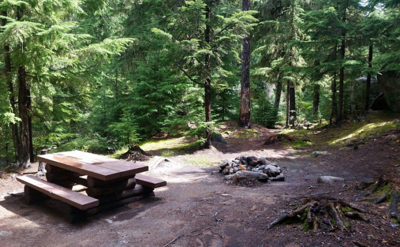
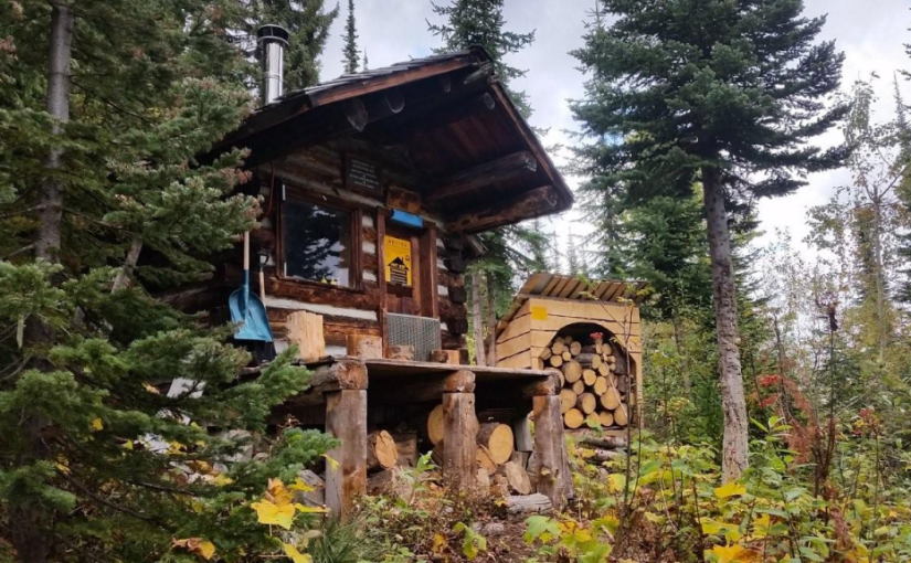
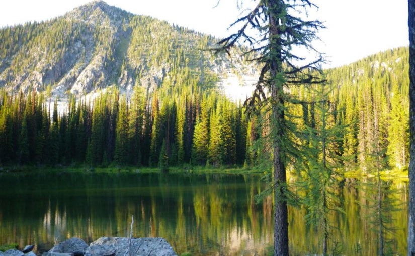
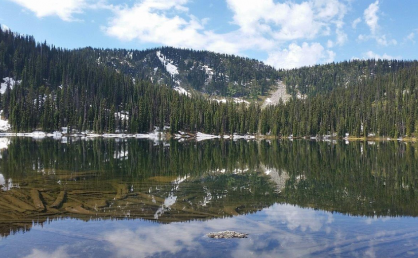
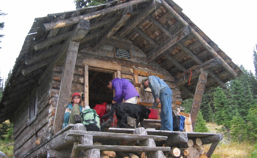
Grassy Hut lies in the middle of the horseshoe just below the pass between Grassy and south Grassy Mountains. The cabin was built by the KMC in 1985, has four bunks (no foam mattresses), a bench table and seating, and a wood stove. Basic cooking utensils (pots, pans, cups, bowls, plates, cutlery, etc.) are stored in a plastic bin. There is also a two burner white gas Coleman Stove and Coleman Lantern (take spare mantels). You will need to bring your own white gas for the stove and lantern. There is NO water at the Grassy Cabin in either summer or winter. A two hectare area around the cabin is designated for non-motorized use only.The cabin is maintained under partnership agreement with Kootenay Mountaineering Club. For detailed information and driving directions please visit: http://www.kootenaymountaineering.bc.ca/grassy.html

Driving Directions: Access in summer and winter is via logging roads out of Bombi Summit. Follow the following driving directions for summer access. Set your odometer to 0 on Highway 3 at Bombi Summit. 0 km = Munson Road and Highway 3, 2.6 km = power line spur to (R), 3.7 km = Lower Munson to (L), stay (R), 3.9 km = West Munson to (L), stay (R), 5.4 km = East Munson to (R), stay (L) 6.3 km = spur to R, stay on mainline, 6.4 km = spur to (R) is Grassy access. Drive a short distance up this road (about 100 metres) and then park. If you have a two wheel drive vehicle, you will have to park off the main road and walk from there. On foot, follow the old road that leads up to the ridge south of Grassy Mountain. Hike downhill (sketchy trail) to find the cabin. Allow one to three hours hiking time. In winter, follow the same directions but ski directly from the highway. Allow four to six hours.

Grizzly Creek Rec Site

Grizzly Creek recreation site is an ideal base camp for explorations up Koch, Greasybill and Grizzly Creeks. This site would make a good rest stop before exploring the rough 4 wheel drive road that goes over the height of land and down to Lower Arrow Lake near Fauquier. The two campsites are scenically situated on rock ledges adjacent to Koch Creek. On a hot summer day the pools below the rock ledges are most inviting. Stream fishing above the bridge rewards the patient angler with brook trout. The surrounding area offers good huckleberry picking and mushroom gathering.

Driving Directions:On Highway 6, near Passmore, look for the Provincial Park signs for “(Valhalla) Drinnon Pass Turn-off”. Following these signs turn left onto “Upper Passmore Road”. The first 3 km of this road are paved. At 3.7 km fork left onto the “Little Slocan Forest Service Road”, a good 2 wheel drive gravel road. Continue on this road following the “Valhalla” signs. At 5.2 km fork right. At 6 km you will cross Airy Creek. At 9 km fork right. At 12.7 km you will cross Koch Creek. At 13.2 km, stop following the “Valhalla” signs and turn left onto the “Koch Creek Forest Service Road”. Travel up Koch Creek for 9.2 km. Turn left, over a major bridge crossing to the other side of Koch Creek. The Grizzly Creek Recreation Site is on your left.

( source : Rec Sites and Trails )

Huckleberry Hut

Huckleberry Hut is a cosy log cabin situated at around 1600 metres in the valley below Midday and Cabin Peaks. It is a small hut with two bunks (no foam mattresses) which will each sleep two. There is also a fold-down table, wood stove and outhouse, and basic cooking utensils (pots, pans, cups, bowls, plates, cutlery, etc.) There is a two burner white gas Coleman Stove and Coleman Lantern, bring spare mantels and white gas. The cabin is maintained under partnership agreement with Kootenay Mountaineering Club. For detailed information and driving directions please visit: http://www.kootenaymountaineering.bc.ca

Driving Directions: Access to the Huckleberry Hut is via Porto Rico Road, 15 km south of Nelson off Highway 6. In summer, with a high clearance four wheel drive vehicle you can drive for six kilometres to a junction where an old road leads off to the left. Park here, and walk the remaining two kilometres to the cabin. In winter a combination of snowmobiles and ski touring gear may be required. The cabin is maintained under partnership agreement with Kootenay Mountaineering Club. For detailed information and drining directions please visit: http://www.kootenaymountaineering.bc.ca/huckleberry.html

Little Slocan Rec Site

A small, semi-open, lakeside campsite.

Driving Directions:The most popular access to Little Slocan Lakes campsite is from Passmore along Highway 6. As you drive through Passmmore heading north turn left off of the highway onto Passmore Upper Road. Cross the river and follow the road for 3.7 km. Turn left onto the Little Slocan Forest Service Rd.. Stay on the main road for approx 21 km to the recreation site on your right.

Milford Lake

Milford Lake is a small site at a sub-alpine lake that is accessible by 4wd high clearance vehicles. The site offers scenic views down Kootenay lake and 2 campsites.

Driving Directions:The Milford Lake road leaves the west side of Highway #31, 9.4 km north of Kaslo. Travel up Milford Lake Road for 8.0 km to a junction. Turn right at this junction and continue for another 0.8 km to the lake. Although there are some steep rough sections, the road is suitable for 2wd high clearance vehicles.

Oliver (Johny Connors) Lake

This is a small site located in a scenic alpine basin with a shallow lake. There is a short trail on the east side of the road to the shallow lake and around it. Access can also be gained to the surrounding ridges, although there are no developed trails.

Driving Directions:From the community of Crawford Bay, head south for 200 meters on Highway3A, and then turn left on Oliver road just past the Gray Creek store. Follow this road for 300 meters and then turn right, crossing Grey Creek. Follow this road , now called Anderson road, for 1.3 km, turning left at the junction. Follow the main Grey Creek road 15.0 km to the campsite.

Pebble Beach Rec Site

This is a popular sunbathing, swimming, and camping site. It is located in a small protected bay on the east shore of Kootenay Lake with a pebble beach surrounded by exposed rock. The site offers fishing, hiking, camping, picnicking, and swimming.

Driving Directions:From the community of Riondel on the East shore of Kootenay Lake, take a right turn onto Eastman Avenue and proceed to Tam O’Shanter Cr. Take the Kootenay Lake East Forest Service Road for 3.2km to the trail head. Park your vehicle on the left side of the road by the trail head sign. A moderate 2.0km trail located on the west side of the road leads into the site. This site is also accessible by boat.

Ross Lake Trail

The Ross Lake trail offers a sub-alpine experience for the whole family. This is a short,but rough, trail that ends at a small alpine lake and provides access to the surrounding ridge system. The primary activities are hiking, fishing, and camping.

Driving Directions:From the ferry terminal at Balfour, travel west on highway #3A for 2.7 km to Beggs Road on the right. Keep to the left, and follow Beggs road for 0.8 km to a fork in the road. Stay left and drive 0.3 km to Redfish Forest service road on the left (cross over Laird Creek). Follow Redfish forest service road (keep right at the junction with the Redfish Research Area) for 10.3 km to a bridge. Drive across the bridge and drive the remaining 1.0 km to a road that leads to the right. The bridge across this road is damaged, so you will need to walk the remaining portion of the road to the trailhead. The trail begins on an old skid trail to the north-west.

Snowater Cabin

A Snowmobile Warming Hut in the Rover Creek area 10km west of Nelson. For more information on the cabin please contact the Slocan Valley Snowmobile Association. If you are staying overnight in the Cabin please consider making a 10$ / person donation (donation box inside) to help with the maintenance and upkeep of the cabin.

Driving Directions:Contact the Slocan Valley Snowmobile Association if you would like directions to the cabin, otherwise good luck on your adventure!

Nelson Sno-goers map

Sasquatch Lake Rec Site

Sasquatch Lake Recreation Site offers attractive campsites big enough for group gatherings. The semi-open site is spacious enough for small motor homes and trailers. This site is popular with huckleberry pickers and picnickers. A rock slide along the lake shore gives access to the warm water, making this a popular swimming hole.

Driving Directions:Travelling north on Highway 6 from Appledale, watch for the “Kokanee Glacier Lemon Creek” Provincial Park signs. Just before the bridge over Lemon Creek, follow the signs and turn right onto a good 2 wheel drive gravel road. Follow the “Kokanee Glacier Park” signs on the “Lemon Creek Forest Service Road”. At about 14.5 km turn right onto a dirt road signed “Sasquatch/6 Mile Lakes”. A half kilometre up this road, turn right at the sign to the Sasquatch Lake Recreation Site.