Phone: 1-250-362-7375
Address: 1919 Columbia Avenue, ROSSLAND, BC V0G 1Y0
Address: 1919 Columbia Avenue, ROSSLAND, BC V0G 1Y0
Address: 2003 2nd Ave, ROSSLAND, BC VOG 1YO
Address: Hwy Junction 3B & 22, ROSSLAND, BC V0G 1Y0
Address: 1520 Spokane Street, ROSSLAND, BC V0G 1Y0
Corner of 8th Ave and Hwy 6, Box 406, New Denver, BC, V0G 1S0
250-551-6940
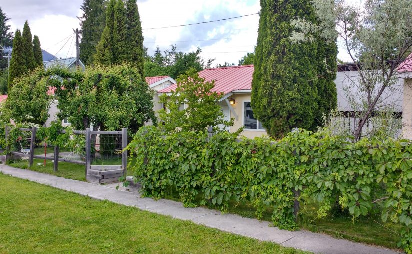
self-contained cabins with full kitchens set in a large grass yard close to downtown New Denver and the Slocan Lake. A perfect base for exploring the area. Adventure tours also available by boat or on bicycle or hiking
Two Options: Bannock Point and Bannock Lookout.
Bannock Point, on the shores of Slocan Lake has special appeal. Walk-in camping is accessed via a 700 meter (1/2 mile), moderately steep trail. A small day-use area and 20 campsites are spread out along the treed and rocky lakeshore. There are also a few campsites located at the parking lot. Early in the morning expect to see eagles and osprey fishing. A small pebble beach catches the afternoon sun. A summer day can easily be whiled away diving in the clear water of Slocan Lake or sun bathing on the huge boulders. A favorite campsite for younger groups from Nelson and Castlegar with relatively short access.
Bannock Lookout Trail, is accessed from the same parking lot but instead of dropping down the lake follows a beautiful forest ledge system out to a series of incredible viewpoints. This is one of my favorite hikes in the Slocan Valley. The trail is about 45 minutes each way with always something different along the trail ending at a 300 ft rock cliff looking south down the Slocan Lake. From the parking lot head straight south. There is a good map board at the parking lot. There are no signs to the trail from anywhere before you get to the parking lot (2015).
Driving Directions: Road Access: From the bridge on Highway 6, in Silverton, travel south along the highway for 4.5 km. Turn right off the highway at the “Bannock Point Trail” sign ( no sign present 2015 ). It is about 3/4 km from the highway to the parking. Access the parking via the lane on the west side of the gravel pit. If you are driving a vehicle with a long wheel base, or towing a trailer, park at the gravel pit and walk down the road to the trail head. Otherwise, you can drive past the gravel pit to the trail head. Park only in designated parking areas to avoid erosion, compaction, and damage to vegetation. Boat Access: From Silverton’s public boat ramp, travel south along the east shore of Slocan Lake for about 4 km. Look for a sheltered bay and the “Bannock Point Recreation Site” sign on the beach.
( Recreation Sites and Trails BC )
Accommodation Options:
More low elevation hikes:
Location: New Denver Area
Time: Plan a full day. Long drive (25km) on rough 2wd road. Lots of scrambling options at the end of the trail. Drive 1hr from New Denver. Hike 3-4 hr return.
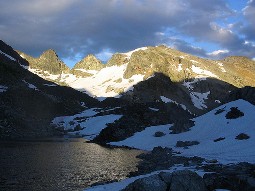
The Alps Alturas trail is a hikers paradise. Alpine flowers, mountain goats, wild rocky vistas, glacial lakes, water falls… it all awaits the hiker with perseverance. Climbing from the trail head through an old cut block, the trail soon picks up an old mining access road. Near the end of the road, the trail takes off to the left, climbing up through the sub-alpine forest to meadows. Frequent bear diggings warn you to be alert, as you are in bear habitat. Between 2.5 km and 3 km on the trail, a short side trip to your right, between rocky knobs, will take you to the old fallen down mine cabin of the Alps Alturas Mine. From here there is a beautiful view of the ridges of Dennis Basin. Now, the slope becomes steeper as the trail angles upward across talus slopes. The first turquoise lake you see will be at your feet, 396 meters (1300 feet) below you, connected to the lakes above by a thread of falling water. Marten Mountain and Inverness Mountain loom ahead. The “beep” of pikas and the shrill whistle of marmots warn other wild life of your presence. Rounding a corner, a raw and rugged landscape comes into view. As you pick your way across the talus, mountain goats scramble along the rock ledges below a remnant glacier. Four glacial lakes rest between Mt. Dolly Varden and Marten Mountain in a landscape of rock and ice.
Driving Directions: Turn off Highway 6, at Rosebery, onto the “East Wilson Creek Road”. This road soon turns into the “Wilson Creek Forest Service Road”. Follow this good, 2 wheel drive, gravel road for 2.6 km. Turn right onto the “Hicks Creek Road”. Reset your odometer, as there are very few kilometre signs on the “Hicks Creek Road”. From here on the road steepens and gets rougher. A high clearance vehicle with good tires is advised. 2.7 km up the “Hicks Creek Road” there is a fork in the road, stay left. At 10.3 km on your odometer you will pass the Dennis Creek Trail turn off. From here the road is narrow. At 19.7 km stay to the left. At 22.3 km on your odometer, continue straight ahead to the upper cut block. In 300 meters stay left and down, crossing over a culvert. At 23.4 km a brown 4×4 post with white lettering, signed “Alps Alturas Tr”, will direct you to the left. Continue for another 2 km, back across the cut block. Park at 25.4 km, at the 4×4 post marking the trail head.
( recreation sites and trails bc )
Accommodation in New Denver:
Other Alpine Hikes:
Request further information:
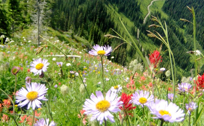
Idaho Peak offers one of the most spectacular flower shows in the Kootenays. The diversity and quantity of flowers is matched only by the diversity and quantity of visitors who come to admire the flowers and take in the 360 degree view from the lookout. This is not the place to come if you are seeking solitude. There are 2 trails to Idaho Lookout. Both meet on the ridge for the last leg of the hike up to the summit. If you would like to take the less travelled trail to the lookout, park at the Alamo parking area. The flowers along this section of the trail are every bit as showy as the ones near the ridge parking lot. Please, keep to the marked trails to avoid destroying the fragile alpine vegetation that you have come to admire. Hike is 30 min – 1 hour return trip 2 hours.
Driving Directions: At the junction of Hwy 6 and 31A in New Denver, turn east onto Hwy 31A and follow the signs to Sandon. The first 2 km of the road is wide, not too steep and well maintained by the mining companies. After this, the road narrows considerably, as it switch backs up the mountain. As you enter Wild Goose Basin, you will find a pleasant picnic site on the edge of the meadow. From here, the rest of the road is clearly visible, as it switch backs up to the 2 parking areas. The most heavily used parking area is on the ridge between Idaho Peak and Selkirk Peak. The Alamo parking area is less crowded. Perfect! Park here to avoid the crowds around the ridge parking lot. 2WD ( 30 minutes to 1 hour )
( recreation sites and trails bc )
Plan on 4-6 hours for the return journey from New Denver. In order to properly appreciate the history of this area a visit to the Sandon Museum ( open 10-5 ) before going up Idaho Peak is well worth an hour.
Popular destination for mountain biking, hiking, paragliding, wildflowers, and photography,
Accommodation Options:
More New Denver Alpine Hikes:
Mountain Biking: