Mt Brennan – Lyle Ck

Popular in the Summer and Winter for ski touring and heli-skiing.

Summer Full Day: Plan on about 2-3 hours up to the lakes and 5 hrs to summit.

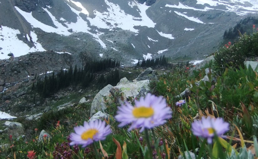
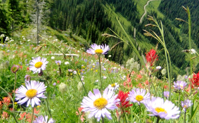
Lyle Creek Trail is a moderate hike to the summit of Mt. Brennan. Small glacial lakes, cascading waterfalls and scenic views are the main attractions of the area. There are also signs of old mining activities in the area. Round trip to Mt. Brennan is 15 KM, Reach the lakes in about half that.

Summer Driving Directions: From the 4 way stop in Kaslo drive highway 3A until you reach approximately 23.3 KM on your odometer and turn north onto Rossiter Creek FSR. Zero Odometer here. Stay on the Rossiter Creek FSR mainline until you reach 2.4 KM and take the left fork. At 7.0 find the trailhead. There are trail markers from the beginning of the Rossiter Creek FSR to the trailhead.

( source: Recreation Sites and Trails BC )

Winter: A very popular ski touring destination. Trail starts at bottom left of photo and traverses into drainage on right to summit on left. Follow directions for summer access and ski tour or snowmobile to start of summer trail and then continue up bench on left which is subject to danger from avalanches sluffing from upper cliffs.  At Lakes climb gully on left which is also subject to avalanche danger from above and then continue traversing right to gain upper bench system. Final short headwall has some more avalanche exposure, get the picture – don’t come here when stability is questionable. Incredible 7,000 ft day with good visibility, often wind affected and typically ascended in the spring.  More photos.

The Ride – S03E02: Giant Peaks, Tiny People from Showtime Films on Vimeo.

New Denver Accommodation Options:

Kaslo Accommodation: 

    New Denver Alpine Hikes: 

    Kaslo Alpine Hikes: 

    Ski Touring around New Denver and Kaslo:


      Mt Whitewater canyon trail

      Summer Hike: 1 hour to Whitewater Canyon for bear viewing, another hour to campsites and a further hour to end of Trail at Mine, Moraine and Glacier. 2 hours out from end of trail. Moderate elevation gain.

      Description: This trail provides access to Whitewater Glacier which is surrounded by an open glaciated landscape of small streams and small puddle-like lakes. It is a very scenic area and provides excellent recreational opportunities. Remains from past mining activities, and an old flume used to divert water, are located near the pass. Watch for mountain goats along the ridges, and be alert for grizzly bears feeding on open alpine slopes. Primary activities are hiking, viewing, camping and mountaineering. High grizzly use area, stay alert.

      Driving Directions:Head west from Kaslo on highway #31A for 28.6 km (measured from downtown Kaslo) to the old settlement of Rettallack. Turn right at the old townsite (keeping left for the first 100 m or so) and then turn right again at 0.3 km. Stay on the well-travelled portion of this road for 1.1 km to the Lyle Creek junction. Follow the left fork of the road for 2.2 km to a road on the right and take this for 0.5 km to a small parking area. This last section of the road is very narrow. You may wish to leave your vehicle at the wide area near the last junction. The trail starts 25 m past the parking area up an old road. Suitable for 2wd high clearance vehicles, although 4wd recommended.

      Also somewhat popular in the winter for ski touring, particularly in the early season when the slopes above the summer parking area are great tree skiing. Lots of options for more adventure in the upper basin. Snowmobile to access logging road helpful.

      Accommodation Options:

      More New Denver Alpine Hikes: 

      More Ski Touring in the area:


        Idaho Peak

        Idaho Peak offers one of the most spectacular flower shows in the Kootenays. The diversity and quantity of flowers is matched only by the diversity and quantity of visitors who come to admire the flowers and take in the 360 degree view from the lookout. This is not the place to come if you are seeking solitude. There are 2 trails to Idaho Lookout. Both meet on the ridge for the last leg of the hike up to the summit. If you would like to take the less travelled trail to the lookout, park at the Alamo parking area. The flowers along this section of the trail are every bit as showy as the ones near the ridge parking lot.  Please, keep to the marked trails to avoid destroying the fragile alpine vegetation that you have come to admire. Hike is 30 min – 1 hour return trip 2 hours.

        Driving Directions: At the junction of Hwy 6 and 31A in New Denver, turn east onto Hwy 31A and follow the signs to Sandon.  The first 2 km of the road is wide, not too steep and well maintained by the mining companies. After this, the road narrows considerably, as it switch backs up the mountain. As you enter Wild Goose Basin, you will find a pleasant picnic site on the edge of the meadow. From here, the rest of the road is clearly visible, as it switch backs up to the 2 parking areas. The most heavily used parking area is on the ridge between Idaho Peak and Selkirk Peak. The Alamo parking area is less crowded. Perfect! Park here to avoid the crowds around the ridge parking lot. 2WD ( 30 minutes to 1 hour )

        ( recreation sites and trails bc )

        Plan on 4-6 hours for the return journey from New Denver. In order to properly appreciate the history of this area a visit to the Sandon Museum ( open 10-5 ) before going up Idaho Peak is well worth an hour.

        Popular destination for mountain biking, hiking, paragliding, wildflowers, and photography,

        Accommodation Options:

        More New Denver Alpine Hikes: 

        Mountain Biking: