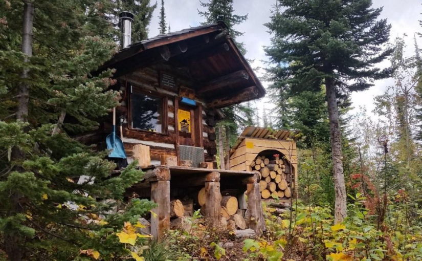
Giveout Creek Cabin

The cabin overlooks the Nelson Valley at an elevation of 1730 Meters. The cabin is primarily used for a warming hut for snowmobilers. There are a few bunks in the cabin for overnight use. There is good snowmobiling in the cut blocks surrounding the cabin and in and around the old mining sites.

Driving Directions:The cabin can be accessed off of Hwy 8 to Ymir out off Nelson. Turn east onto Giveout Creek FSR for +/- 1.6 km and then onto Gold Creek FSR for +/- 5 Km, then bear right at the junction. Follow this road for 3 more KM . At this point there is an old logging skid road for 300 meters up to the cabin. There is usually lots of snowmobile tracks leading to the cabin. The trail in is occasionally groomed by the nelson sno-goers club. Cabin Location is N49�25.602 W117�17.722

more information at http://nelsonsno-goers.webs.com/

Grassy Mountain Hut

Grassy Hut lies in the middle of the horseshoe just below the pass between Grassy and south Grassy Mountains. The cabin was built by the KMC in 1985, has four bunks (no foam mattresses), a bench table and seating, and a wood stove. Basic cooking utensils (pots, pans, cups, bowls, plates, cutlery, etc.) are stored in a plastic bin. There is also a two burner white gas Coleman Stove and Coleman Lantern (take spare mantels). You will need to bring your own white gas for the stove and lantern. There is NO water at the Grassy Cabin in either summer or winter. A two hectare area around the cabin is designated for non-motorized use only.The cabin is maintained under partnership agreement with Kootenay Mountaineering Club. For detailed information and driving directions please visit: http://www.kootenaymountaineering.bc.ca/grassy.html

Driving Directions: Access in summer and winter is via logging roads out of Bombi Summit. Follow the following driving directions for summer access. Set your odometer to 0 on Highway 3 at Bombi Summit. 0 km = Munson Road and Highway 3, 2.6 km = power line spur to (R), 3.7 km = Lower Munson to (L), stay (R), 3.9 km = West Munson to (L), stay (R), 5.4 km = East Munson to (R), stay (L) 6.3 km = spur to R, stay on mainline, 6.4 km = spur to (R) is Grassy access. Drive a short distance up this road (about 100 metres) and then park. If you have a two wheel drive vehicle, you will have to park off the main road and walk from there. On foot, follow the old road that leads up to the ridge south of Grassy Mountain. Hike downhill (sketchy trail) to find the cabin. Allow one to three hours hiking time. In winter, follow the same directions but ski directly from the highway. Allow four to six hours.
Huckleberry Hut

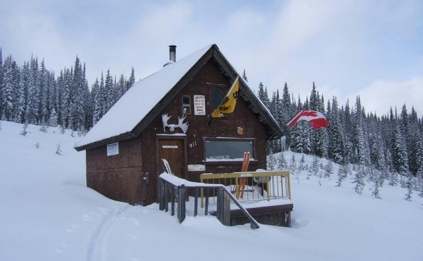
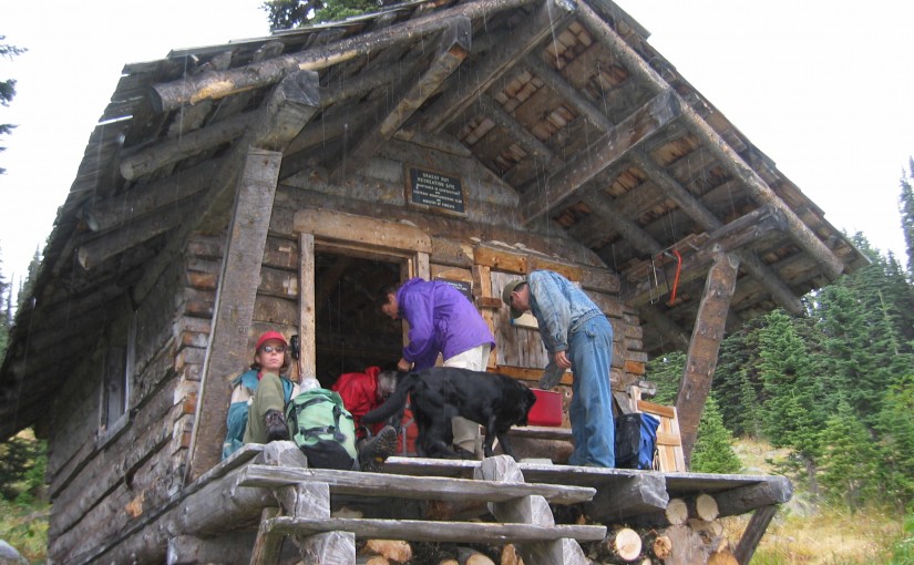
Huckleberry Hut is a cosy log cabin situated at around 1600 metres in the valley below Midday and Cabin Peaks. It is a small hut with two bunks (no foam mattresses) which will each sleep two. There is also a fold-down table, wood stove and outhouse, and basic cooking utensils (pots, pans, cups, bowls, plates, cutlery, etc.) There is a two burner white gas Coleman Stove and Coleman Lantern, bring spare mantels and white gas. The cabin is maintained under partnership agreement with Kootenay Mountaineering Club. For detailed information and driving directions please visit: http://www.kootenaymountaineering.bc.ca

Driving Directions: Access to the Huckleberry Hut is via Porto Rico Road, 15 km south of Nelson off Highway 6. In summer, with a high clearance four wheel drive vehicle you can drive for six kilometres to a junction where an old road leads off to the left. Park here, and walk the remaining two kilometres to the cabin. In winter a combination of snowmobiles and ski touring gear may be required. The cabin is maintained under partnership agreement with Kootenay Mountaineering Club. For detailed information and drining directions please visit: http://www.kootenaymountaineering.bc.ca/huckleberry.html

Kokanee Creek Old Growth Trail

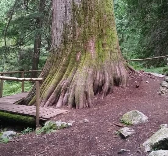
This is an easy to moderate interpretive trail through an old cedar/hemlock forest. Features of the trail include large stands of huge cedar tree, lush creek side habitat, an avalanche path, and historic remains of turn-of-the-century mining and logging.

Driving Directions:Travel east of Nelson for 19.0 km on highway #3A to the Gibson Lake/Kokanee Glacier Provincial Park access road. Travel along the access road for 11.4 km to the trailhead sign. Parking for 6 vehicles is located approximately 50 meters beyond the trailhead sign. When starting the trail, keep to the left at the fork. The right fork leads down to a viewpoint.

Ross Lake Trail

The Ross Lake trail offers a sub-alpine experience for the whole family. This is a short,but rough, trail that ends at a small alpine lake and provides access to the surrounding ridge system. The primary activities are hiking, fishing, and camping.

Driving Directions:From the ferry terminal at Balfour, travel west on highway #3A for 2.7 km to Beggs Road on the right. Keep to the left, and follow Beggs road for 0.8 km to a fork in the road. Stay left and drive 0.3 km to Redfish Forest service road on the left (cross over Laird Creek). Follow Redfish forest service road (keep right at the junction with the Redfish Research Area) for 10.3 km to a bridge. Drive across the bridge and drive the remaining 1.0 km to a road that leads to the right. The bridge across this road is damaged, so you will need to walk the remaining portion of the road to the trailhead. The trail begins on an old skid trail to the north-west.

Sasquatch Lake Rec Site

Sasquatch Lake Recreation Site offers attractive campsites big enough for group gatherings. The semi-open site is spacious enough for small motor homes and trailers. This site is popular with huckleberry pickers and picnickers. A rock slide along the lake shore gives access to the warm water, making this a popular swimming hole.

Driving Directions:Travelling north on Highway 6 from Appledale, watch for the “Kokanee Glacier Lemon Creek” Provincial Park signs. Just before the bridge over Lemon Creek, follow the signs and turn right onto a good 2 wheel drive gravel road. Follow the “Kokanee Glacier Park” signs on the “Lemon Creek Forest Service Road”. At about 14.5 km turn right onto a dirt road signed “Sasquatch/6 Mile Lakes”. A half kilometre up this road, turn right at the sign to the Sasquatch Lake Recreation Site.

Six Mile Lakes

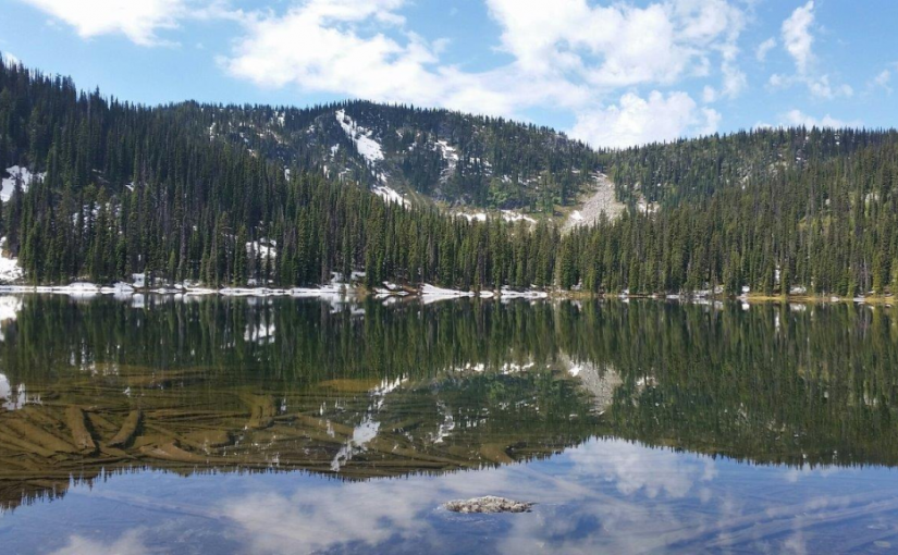
Six Miles Lake site is a series of three connected sub-alpine lakes. A rustic 3.0 km nature trail on the west side of the lake offers views of the lakes and a pleasant walk through the forest. The trail head is just south of the recreation site on the west side of the road. The end of the trail rejoins the road past the furthest lake, and you can walk back along the road to the trailhead. This is the headwaters of a domestic – use watershed. Please respect the lakes and creeks.

Driving Directions:Travel north from Nelson on highway #3A for 8.0 km to Six Mile Lakes road. Follow Six Miles Lakes road for 10.0 km to a fork in the road. Then take the right fork for 3.0 km to the recreation site . The road is suitable for a 2wd vehicles, although the last 3.0 km are very rough in sections.

(source: Recreation Sites and Trails )

In the winter the six mile lakes circuit is popular with snowmobilers connecting the road across to Lemon creek in the Slocan Valley. Nelson Snowgoers for more information

There are some ski touring destinations in the area as well.

Sproule Creek Trail

This trail follows an old wagon trail and railroad constructed by the A.G. Lambert Lumber Co. Ltd. between 1919 and 1930. The trail provides access to the old mill site and opportunities for ridge-top hiking. The Westside loop is a cross country ski loop. It is rough and not suitable for hiking or riding. The east fork trail is a short 1.5 km (one way) trail of moderate difficulty. The gentle slope of trail gives it an “easy” rating, although there are some rough sections. The trail is used by mountain bikers, horseback riders, hunters, cross-country skiers, and hikers.

Driving Directions:From the community of Nelson, head west along highway #3A for 11.3 km to Sproule Creek Road. Follow this road for 4.0 km to the parking lot. The trailhead is located approximately 100 m up a private drive on the west side of the creek. This road is suitable for 2wd vehicles.

(source: Rec Site and Trails )