Octopus Creek Rec Site

Octopus Creek flows into Lower Arrow Lake. The recreation site is located at the mouth of the creek in a crescent bay. Boaters find it a safe retreat for waiting out storms and sudden winds. During low water, there is an expansive sand and cobble stone beach. Kids can spend endless hours here playing in the water, and moving sand and rocks around. The water warms up later in the summer and is quite pleasant for swimming and board sailing. Arrow Lake is known for Kokanee fishing. However, if the fish are not biting, there is still lots to do at Octopus Creek. Hikers can hike up the creek searching for the natural hot springs. At low water there is miles of beach to walk.

Driving Directions:Due to private land issues this site has been changed to BOAT ACCESS ONLY

Snowshoe Lake Rec Site

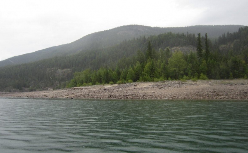
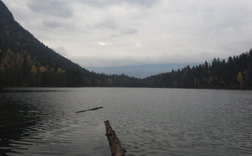
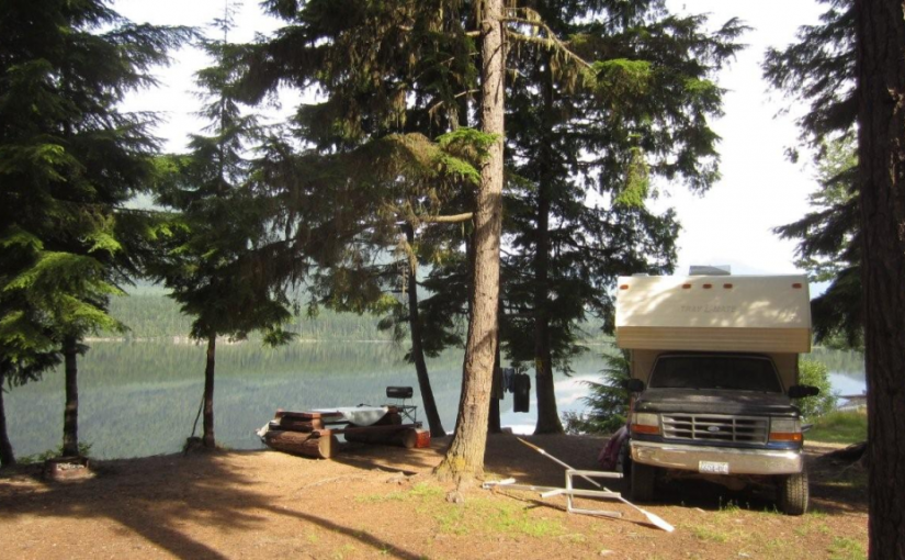
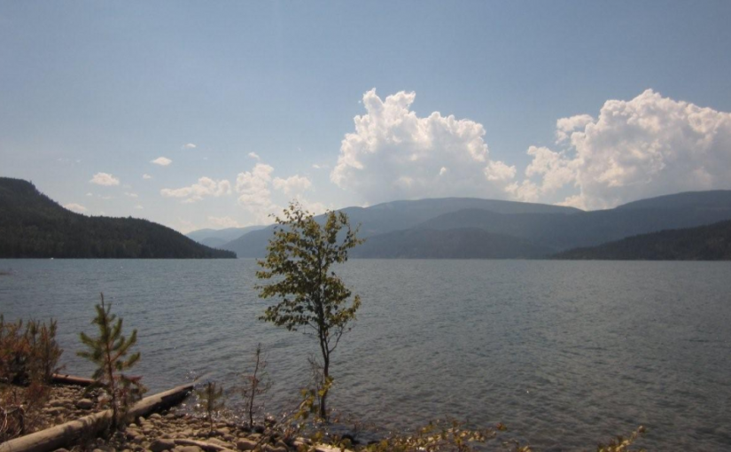
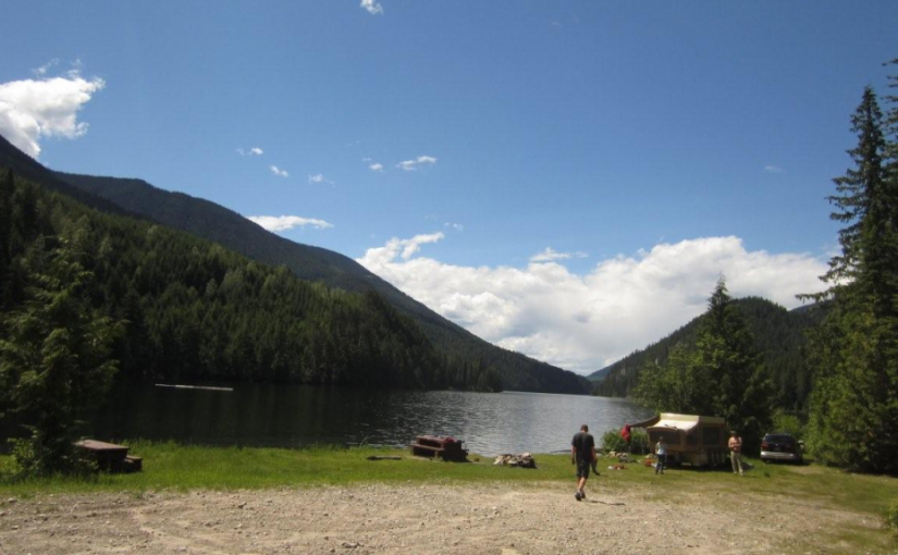
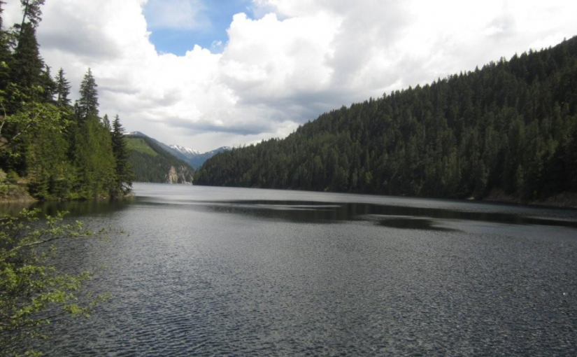
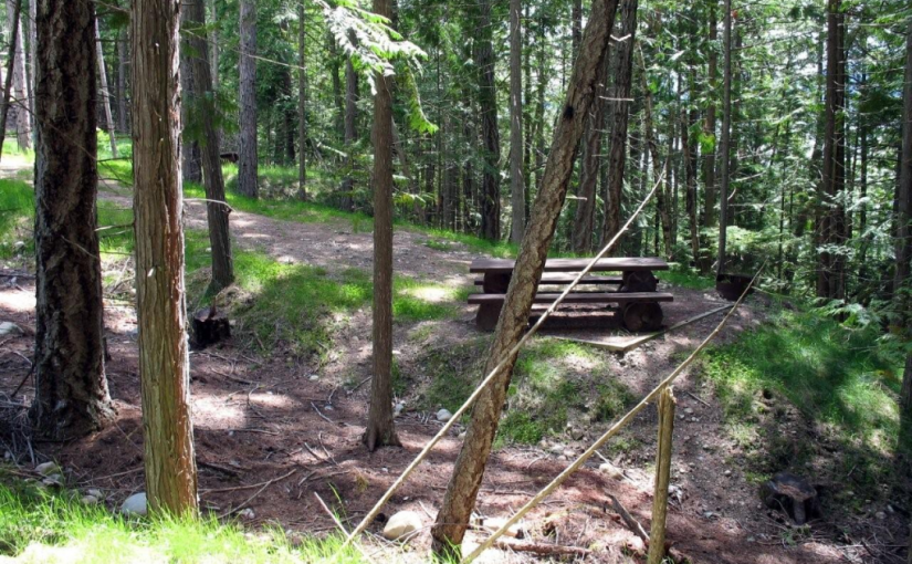
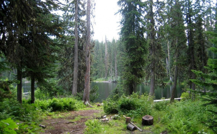
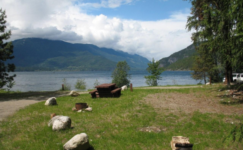
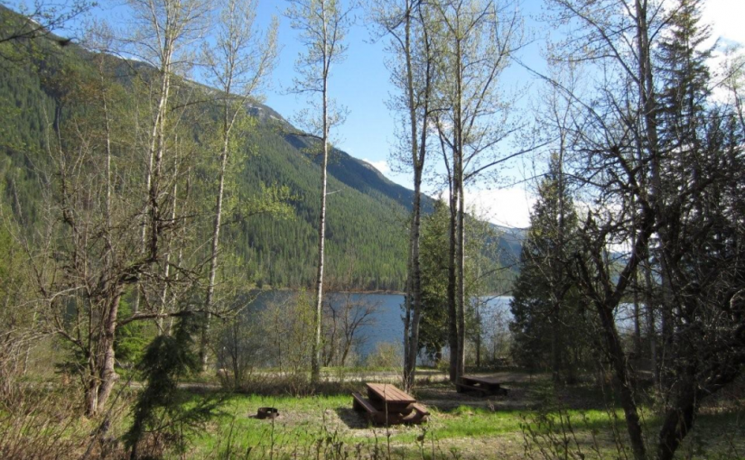
This small fishing lake, tucked into the hills, is a pleasant spot to while away a few hours or days. Although there is not a boat launch, the road goes close enough to the lake that a canoe can easily be put in. There is a choice of grassy or treed campsites.

Driving Directions:Access: From the Needles Rest Area at the ferry terminus, travel west on Highway 6 for 14.4 km.Just before the highway crosses Inonoaklin Creek, turn right onto a 2 wheel drive gravel road. Follow this road through the gravel pit onto a rough dirt road. After crossing a cattle guard at 1.5 km the road forks. Take the right fork, marked with a brown 4×4 post with white lettering, signed “Snowshoe Lake”. Continue along this road for another 3 km to the recreation site. Note: this road is suitable for high clearance 2 wheel drive vehicles in dry weather. Alternate Access: From the Needles Rest Area at the ferry terminus, travel west on Highway 6 for 4.4 km. Turn right onto the “Whatshan Lake Road”. At the junction with the Barnes Creek road, turn left and cross over the Whatshan River. Just past the power station, which is at the “7 km” marker on the “Barnes Creek Forest Service Road”, turn left onto the “Snowshoe Lake Road”, which is marked with a white and red sign, nailed to a tree. Proceed 1.4 km. Turn left onto a road marked “Branch 1”. Proceed 1.5 km to just past a “10 km” yellow and black marker on the right hand side of the road. Turn right onto a narrow, dirt 2 wheel drive road that follows the power lines for 2 km to Snowshoe Lake. Note: the last 1.6 km is very steep, narrow and rutted, suitable for high clearance 2 wheel drive vehicles in dry weather.

(source: rec sites and trails)

Stevens Creek Rec Site ( Whatshan lake )

Whatshan Lake is a boating and popular fishing lake with more to offer than just big fish. In summer the lake warms up to very pleasant swimming temperature. Stevens Creek is very scenic. Whatshan Peak is directly across the lake and the Pinnacles loom in the distance. Large white pine trees shade level campsites. Some of the sites are clustered together, making them perfect for group camping. There is a day use area for picnicking and enjoying the pea gravel and sand beach. Camping Fees will be collected from May to October Annually at a rate of $12.00/night. Boat Launch

Driving Directions: Access from the Needles Ferry: Zero your odometer at the Needles ferry landing on the Edgewood side. At 3.2 KM turn right off the highway on to Whatshan Lake Road. At 4.7 KM turn right on to Whatshan Forest Service Road. At 5.6 KM find a junction, stay on the main line. At 18.5 Proceed Left and stay on the Whatshan FSR. At 26.8 KM proceed left at the junction staying on the Whatshan FSR. At 27 KM pass the Richy Recreation Site on the left. At 28.8 Find Stevens Creek Recreation Site on the left. Directions from Arrow Park Ferry: When leaving the ferry stay left onto: Stevens Road to Needles. At 8.9 Km take the left fork sign: To Needles/ Old Arrow Park . At 11.5 Km take the right fork sign: Whatshan Lake Richy/ Stevens. AT 23.2 Km Stay right onto Branch 1 Stevens. At 24.7 Km hairpin left onto Whatshan Rd. going South. At 26.1 Km Stevens Campground on Right. At 28.3 Km Richy Campground on Right.

Taite Creek

Taite Creek flows into Lower Arrow Lake. The recreation site is located on the north side of Taite Creek, on the shore of Lower Arrow Lake. It is a great spot to camp while fishing Lower Arrow Lake. During low water, there is a sand and cobble stone beach. The campsites are in a semi-open stand of mature trees. There is lots of opportunity to camp on the beach. The water warms up later in the summer and is quite pleasant for swimming and board sailing. Perennial sweet peas along the shore hint at the old settlements that were here, before the area was flooded by the Hugh Keenleyside Dam. For the back roads traveller, Taite Creek makes a good rest stop on the rough 4 wheel drive road that goes over the Valkyr Range. This road ties into the “Koch Creek Forest Service Road” which leads down to the Slocan Valley. 5 campsites.

Driving Directions: From the junction of Highway 6 and “Applegrove Road” in Fauquier, travel south on “Applegrove Road” for 9.6 km on a good, 2 wheel drive, gravel road. 100 meters before the bridge over Taite Creek, turn right onto a dirt road. Follow this narrow, 2 wheel drive road for 1 km to the recreation site on the lake shore.

Wilson Lake East

Wilson Lake offers good boating. This 4.5 km long lake is deep and narrow. Most of the shoreline is steep and accessible only by boat. The recreation site, on a flat at the east end of the lake offers a large open area, with the campsites around the edge of the clearing, ideal for group gatherings. Trout fishing in the lake and in Fitzstubbs Creek can be rewarding. Miles of forestry roads in the vicinity are popular with bikers and ATV users.

Driving Directions:Access from Rosebery: Turn off Highway 6, at Rosebery, onto the “East Wilson Creek Road”. This road soon turns into the “Wilson Creek Forest Service Road”. Follow this good 2 wheel drive gravel road. At 5 km the road forks, stay left. At 33 km a dirt road crosses the “Wilson Creek Forest Service Road”, continue on the gravel road to the left. “Wilson Lake East Recreation Site” is straight ahead, at 34 km, just before the road crosses a bridge over Fitzstubbs Creek. Access from Nakusp: From the junction of Highway 6 and 23 in Nakusp, travel east on Highway 6 towards New Denver for 6.3 km. Turn left onto the “Wilson Lake Road”. Take this good 2 wheel drive, gravel road up Wensley Creek, past the sawmill. 7 km up the road, turn right onto the “Wilson Lake Forest Service Road”. Follow this rough 2 wheel drive road for 7 km, as it climbs steeply over the rocky bluffs south of Wilson Lake. Several spur roads come onto it from the right. Stay straight ahead at all of these, eventually descending to the shore of Wilson Lake. The recreation site at the end of the lake, is visible across the lake, from the last steep descent.

Wilson Lake West

Wilson Lake offers good fishing and boating. This 4.5 km long lake is deep and narrow. Most of the shoreline is steep and accessible only by boat. The recreation site at the west end reflects the character of the lake. It is a narrow strip at the base of a steep cliff offering little room for over night camping, but it is a pleasant picnic spot. The shoreline drops quickly away. However, a nearby float provides a platform to cast from for the ever elusive trout. There are two campsites.

Driving Directions:From the junction of Highway 6 and 23 in Nakusp, travel east on Highway 6 towards New Denver for 6.3 km. Turn left onto the “Wilson Lake Road”. Take this good 2 wheel drive, gravel road up Wensley Creek, past the sawmill. Stay left at the “Wilson Lake Forest Service Road” junction. Continue straight ahead for another 700 meters to another junction. Take the right fork, down a good 2 wheel drive dirt road, for 400 meters to the Wilson Lake West Recreation Site.

Barnard Beach Rec site

This popular recreation site consists of a mix of vehicle campsites (not on the lake) and tent sites (on the lake).

Driving Directions:From the community of Riondel on the east shore of Kootenay Lake, take a right turn on to Eastman Avenue and proceed to Tam O’Shanter Creek. Take the Kootenay Lake East forest service road 9.0 km to the Bernard forest service road junction, then take the left fork for 3.0 km to the site. The road is suitable for 2wd vehicles.


Cooley Lake Rec Site

The drive up to Cooley Lake is a good outing, even if you are not a fisherman. The Goose Creek swimming holes by the bridge (at km 1.5) are worth stopping at on a hot day. Near the 10 km sign on the “Goose Creek Road”, the road traverses an open ridge giving panoramic views of the Bonnington Range, the Valhallas, Shoreacres, Crescent Valley and Krestova. Cooley Lake is a very popular fishing lake that is stocked with rainbow trout. Access to the lake shore is on a short hiking trail through a dense sub-alpine forest. Fishing is done from logs jutting out from the shoreline. There are no tent sites at the lake. Campers stay at the trailhead, just off the road.

Driving Directions:From the junction of Highway 3 and 22, at the overpass in Castlegar, travel east on Highway 3 and Highway 3A towards Nelson for 5.1 km. Turn right at the “Syringa Creek Turn Off” sign onto the “Robson Access Road”. Follow this road for 2.8 km. Turn right onto the “Pass Creek” road. Follow this winding paved road for 11.5 km. Turn left onto the “Goose Creek Road”. The pavement soon gives way to a good 2 wheel drive gravel road that climbs steadily. At 7 km stay right, crossing over Gander Creek. At 9 km stay right, crossing over another small bridge. At 9.3 km stay left, following the main road. At 13.3 km you will get glimpses of Cooley Lake on your right. The parking area for the trail to Cooley Lake is at 13.6 km.

Garland Bay Rec Site

This is an enhanced site and has a $12 per night charge. Garland Bay is a large open beach site on the east shore of Kootenay Lake. This site receives very heavy use during the summer season. Very popular area for swimming, camping, fishing and boating. 22 campsites.

Driving Directions: From the community of Riondel on the east shore of Kootenay Lake, take a right turn on to Eastman Avenue and proceed to Tam O’Shanter Creek. Take the Kootenay Lake East forest service road 9.0 km to the Bernard forest service road junction, then take the left fork for 4.0 km to the site. The road is suitable for 2wd vehicles.

(source: rec sites and trails )

Little Slocan Rec Site

A small, semi-open, lakeside campsite.

Driving Directions:The most popular access to Little Slocan Lakes campsite is from Passmore along Highway 6. As you drive through Passmmore heading north turn left off of the highway onto Passmore Upper Road. Cross the river and follow the road for 3.7 km. Turn left onto the Little Slocan Forest Service Rd.. Stay on the main road for approx 21 km to the recreation site on your right.