Saddle Mountain Fire Lookout

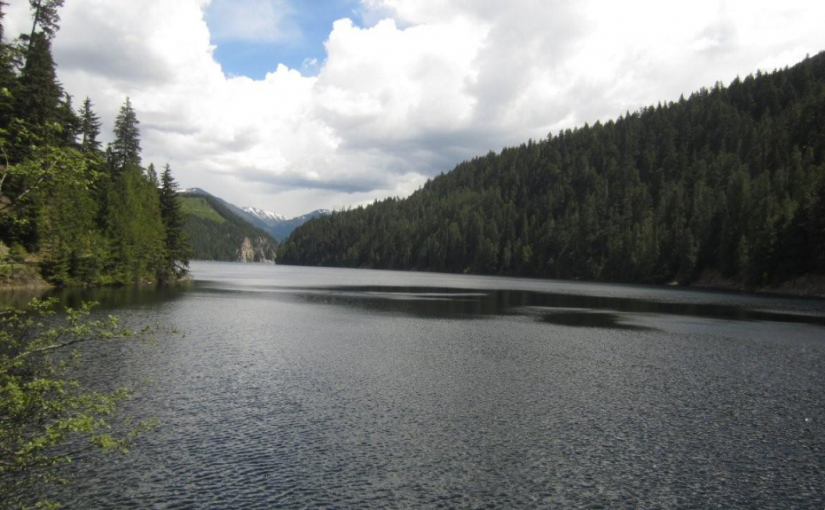
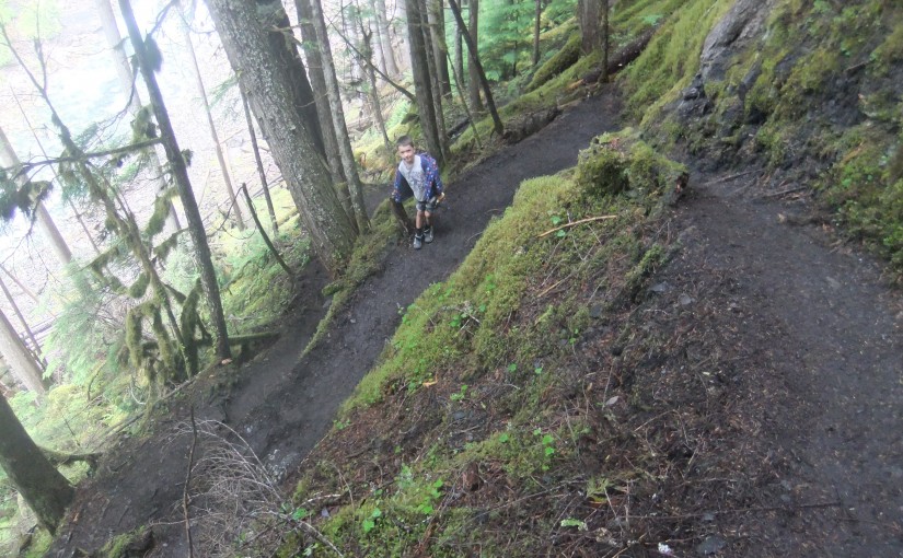
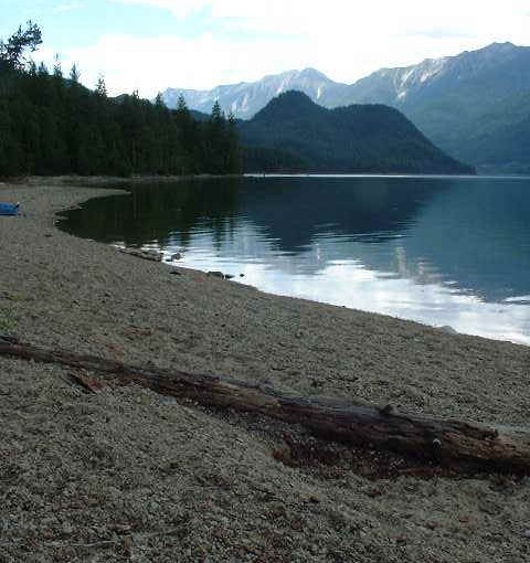
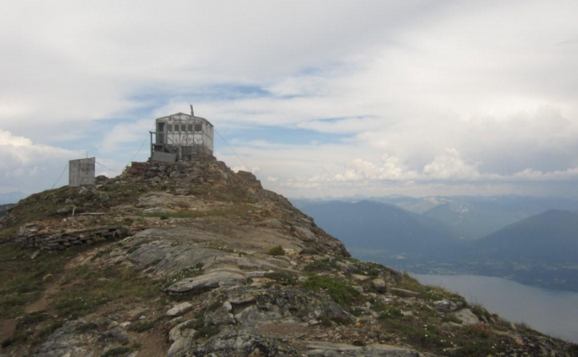
Saddle Mountain Fire Lookout sits on top of Saddle Mountain elevation 2304 m / 7559 ft , to the North is Upper Saddle Mountain elevation 2330 m / 7644 ft . The view is spectacular of Arrow Lake and Nakusp BC . To the west is Pinnacle Peak elevation 2573 m / 8441 ft . and the Monashee Mountians. 3-5 hour hike. 2 hour drive access from Nakusp. More information from www.nakusptrails.ca

Driving Directions: Off Hwy 6 onto Arrow Park Road which will also cross the lake with Arrow Park Ferry for +/- 1.4 km and heading in a Northwesterly direction linking up to Saddle Bay South One Forest Service Road for +/- 3.7 km. . Then onto a logging road for +/- 3.7 km continuing along the lake Northward. Then you will arrive at Saddle Mtn. Forest Service Road and travel west up a winding road for +/- 8.2 km to the lookout trail head from this point it is a steep hike .

Snowshoe Lake Rec Site

This small fishing lake, tucked into the hills, is a pleasant spot to while away a few hours or days. Although there is not a boat launch, the road goes close enough to the lake that a canoe can easily be put in. There is a choice of grassy or treed campsites.

Driving Directions:Access: From the Needles Rest Area at the ferry terminus, travel west on Highway 6 for 14.4 km.Just before the highway crosses Inonoaklin Creek, turn right onto a 2 wheel drive gravel road. Follow this road through the gravel pit onto a rough dirt road. After crossing a cattle guard at 1.5 km the road forks. Take the right fork, marked with a brown 4×4 post with white lettering, signed “Snowshoe Lake”. Continue along this road for another 3 km to the recreation site. Note: this road is suitable for high clearance 2 wheel drive vehicles in dry weather. Alternate Access: From the Needles Rest Area at the ferry terminus, travel west on Highway 6 for 4.4 km. Turn right onto the “Whatshan Lake Road”. At the junction with the Barnes Creek road, turn left and cross over the Whatshan River. Just past the power station, which is at the “7 km” marker on the “Barnes Creek Forest Service Road”, turn left onto the “Snowshoe Lake Road”, which is marked with a white and red sign, nailed to a tree. Proceed 1.4 km. Turn left onto a road marked “Branch 1”. Proceed 1.5 km to just past a “10 km” yellow and black marker on the right hand side of the road. Turn right onto a narrow, dirt 2 wheel drive road that follows the power lines for 2 km to Snowshoe Lake. Note: the last 1.6 km is very steep, narrow and rutted, suitable for high clearance 2 wheel drive vehicles in dry weather.

(source: rec sites and trails)

Taite Creek

Taite Creek flows into Lower Arrow Lake. The recreation site is located on the north side of Taite Creek, on the shore of Lower Arrow Lake. It is a great spot to camp while fishing Lower Arrow Lake. During low water, there is a sand and cobble stone beach. The campsites are in a semi-open stand of mature trees. There is lots of opportunity to camp on the beach. The water warms up later in the summer and is quite pleasant for swimming and board sailing. Perennial sweet peas along the shore hint at the old settlements that were here, before the area was flooded by the Hugh Keenleyside Dam. For the back roads traveller, Taite Creek makes a good rest stop on the rough 4 wheel drive road that goes over the Valkyr Range. This road ties into the “Koch Creek Forest Service Road” which leads down to the Slocan Valley. 5 campsites.

Driving Directions: From the junction of Highway 6 and “Applegrove Road” in Fauquier, travel south on “Applegrove Road” for 9.6 km on a good, 2 wheel drive, gravel road. 100 meters before the bridge over Taite Creek, turn right onto a dirt road. Follow this narrow, 2 wheel drive road for 1 km to the recreation site on the lake shore.

Wensley Creek Cross Country Ski Area

Wensley Creek Cross Country Ski Trails offer 9 kilometres of groomed classic track skiing for both beginner and intermediate skiers. The trail is usually ready for skiing by mid-late December, and the season extends through to late March, with variable conditions throughout the season and even along different sections of the trail. Bringing a variety of waxes is recommended. Horseback riding, hiking, and mountain biking are available in the off season.

Driving Directions:Head south from Nakusp on Highway 6 toward Nelson for about 4 kilometres, Turn left on Upper Brouse Road and follow it to the top through a series of turns until reaching the parking area for the trails.

(source: rec sites and trails )

Wilson Lake East

Wilson Lake offers good boating. This 4.5 km long lake is deep and narrow. Most of the shoreline is steep and accessible only by boat. The recreation site, on a flat at the east end of the lake offers a large open area, with the campsites around the edge of the clearing, ideal for group gatherings. Trout fishing in the lake and in Fitzstubbs Creek can be rewarding. Miles of forestry roads in the vicinity are popular with bikers and ATV users.

Driving Directions:Access from Rosebery: Turn off Highway 6, at Rosebery, onto the “East Wilson Creek Road”. This road soon turns into the “Wilson Creek Forest Service Road”. Follow this good 2 wheel drive gravel road. At 5 km the road forks, stay left. At 33 km a dirt road crosses the “Wilson Creek Forest Service Road”, continue on the gravel road to the left. “Wilson Lake East Recreation Site” is straight ahead, at 34 km, just before the road crosses a bridge over Fitzstubbs Creek. Access from Nakusp: From the junction of Highway 6 and 23 in Nakusp, travel east on Highway 6 towards New Denver for 6.3 km. Turn left onto the “Wilson Lake Road”. Take this good 2 wheel drive, gravel road up Wensley Creek, past the sawmill. 7 km up the road, turn right onto the “Wilson Lake Forest Service Road”. Follow this rough 2 wheel drive road for 7 km, as it climbs steeply over the rocky bluffs south of Wilson Lake. Several spur roads come onto it from the right. Stay straight ahead at all of these, eventually descending to the shore of Wilson Lake. The recreation site at the end of the lake, is visible across the lake, from the last steep descent.

Wilson Lake West

Wilson Lake offers good fishing and boating. This 4.5 km long lake is deep and narrow. Most of the shoreline is steep and accessible only by boat. The recreation site at the west end reflects the character of the lake. It is a narrow strip at the base of a steep cliff offering little room for over night camping, but it is a pleasant picnic spot. The shoreline drops quickly away. However, a nearby float provides a platform to cast from for the ever elusive trout. There are two campsites.

Driving Directions:From the junction of Highway 6 and 23 in Nakusp, travel east on Highway 6 towards New Denver for 6.3 km. Turn left onto the “Wilson Lake Road”. Take this good 2 wheel drive, gravel road up Wensley Creek, past the sawmill. Stay left at the “Wilson Lake Forest Service Road” junction. Continue straight ahead for another 700 meters to another junction. Take the right fork, down a good 2 wheel drive dirt road, for 400 meters to the Wilson Lake West Recreation Site.

Wilson Creek Falls

A steep hike down to a cool, mossy waterfall. Wilson Creek Falls is considered one of the most spectacular waterfalls in British Columbia, plunging 207 feet. The hike is 2.2 km round trip. Trail is fairly flat for first 500 m and then drops down to the base of the falls. Plan on about 3-4 hours return trip from highway turn-off.

Directions: Head 5.3 km north of New Denver on Highway 6. Turn east ( right ) on East Wilson Creek FSR 11.5 km ( rough gravel road ) and then turn right just before bridge over Wilson Creek at turnoff signed for Wilson Creek Falls. A 4X4 road climbs 1km to trailhead or high clearance 2wd in 2015.

Wragge Beach

Popular Drive to Campsite on Slocan Lake

Wragge Beach is one of the prettiest beaches on Slocan Lake. The spacious campsites along the lake shore are shaded by trees. A wide beach curves gently for several hundred meters in both directions, inviting beach walking. A rocky outcrop extends out into the lake, making a scenic shoreline. This site is a popular destination campsite for vacationing families. The lake offers good fishing, boating, swimming and board sailing. The wide sandy beach, sloping gently down to the water, is safe for youngsters and provides a perfect volleyball court or frisbee field. If one tires of lazy beach days, a hike into Shannon Lake or Wragge Lake should satisfy the urge to stretch the legs.

Driving Directions:From the junction of Highway 6 and 31A in New Denver, travel north on Highway 6 for 15.2 km to Hills. Turn left onto “Bonanza Road”. Follow the asphalt over the bridge, onto gravel at the beginning of the “Shannon Creek Forest Service Road”. Turn right onto this road, and zero your odometer here. Follow the main line for 2.9 KM and go left here at the fork, turning onto Wragge Creek Road. At 4.2 KM on the odometer, go left at the junction. At 5.4 on the odometer, go left at the junction. At 7.5 KM proceed straight on the main line. At 9.4 KM find Wragge Beach. (note your vehicle odometer reading will not be the same as the Forest Service Road KM markings)